Flying With Expired Data
I was thrilled when the first LORAN with waypoint databases made life ever so much easier and, ultimately, safer through improved situational awareness. But it came at a cost to keep the data current, and all of us pilots have objected to the cost from day one. As a result, many pilots choose to fly without the latest digital data.
Whats Legal When Obsolete?
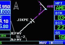
There are two aspects to the legality of obsolete data: navigation and information. The legality of using obsolete data for navigation can be found in your Flight Manual Supplement. The Limitations section of the Garmin 530W Flight Manual Supplement simply states IFR en route and terminal navigation is prohibited unless the pilot verifies the currency of the database or verifies each selected waypoint for accuracy by reference to current approved data.
More Required Reports
Last months clinic began a detailed look at the reports we are required to give ATC or FSS during an IFR flight. Specifically, we began looking at the reports other than the position reports required by 14 CFR 91.183(a), which well cover separately. The remaining reports come from three sources: 14 CFR 91.183 (paragraphs b and c), 14 CFR 91.187, and AIM 5-3-3.
Approach Clinic: Not a Real Alternate?
Several months back reader Jim Gibertoni in Alaska forwarded me a letter he wrote to the FAA administrator, Randy Babbit. Heres a line from that letter: My question is simple: How does one FAA Part 91 pilot in Fairbanks, Alaska, get the attention of the FAA before the next crash happens in Fairbanks?
Is a Ceiling Sealing?
We have all been told old wives tales. Their problem is that they can take on a life of their own. Are the old wives right? Is there a bit of truth to them? Or are they just plain wrong? When it comes to ceilings as part of landing minimums the answer is a bit complicated. It begs the question, are ceilings sealing for instrument pilots or not?
VDP Limitations
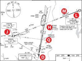
Say youre flying to Asheville, North Carolina on a rainy IMC day. The visibility is hovering around a mile and a half and the ceiling is 1200 feet. ATC has you on vectors for the RNAV (GPS) RWY 34. Without a WAAS GPS in your Turbo Bugsmasher, youre stuck with the LNAV minimums. The weather is above the Category B minimums that youll be using, so you shouldnt have any problems. Right?
GO DIRECT, FIX-BY-FIX
The original structure of the National Airspace System (NAS), with its VORs, airways and intersections, has served us well for decades. But its rapidly becoming outdated in this age of direct navigation between most any two places on the globe. A more structured system already exists: Its called the National Reference System (NRS).
Low over water
It may come as a surprise to you that, from time to time, we endanger our lives and that of our passengers, and sometimes even violate FARs, when we accept a clearance from ATC.
Straight to the middle
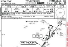
When youre flying a high-tech aircraft, you expect any fix the controller throws at you will be ready to go in your database. Thats probably why an Eclipse pilot accepted a clearance to JISEV for the ILS Rwy 22 approach into Evansville, Ind. JISEV is an intermediate fix (IF) for the approach, and clearing the aircraft to it and then for the approach acts as a proxy for vectoring the aircraft onto the final approach course. Neat and simple for everyone.
Height above What?
I always thought the term TCA-Terminal Control Airspace-had the right ominous overtones for airspace I didnt want to blunder into as a newbie pilot. In comparison, Class B airspace sounds like a factory second the FAA picked up at a bargain price. (The border is a bit ragged on the south side, but dont worry about it, no one will notice.)
Visual Departures for IFR
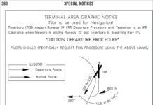
An item recently crossed our desks that has caused some head scratching: Teterboro had a revised charted visual departure procedure for IFR clearances. Of course, everyone knows about SIDs-weve analyzed bunches of 'em in these pages over the years. And most of us will occasionally ask for a VFR departure. Visual approaches (charted or not) are common.
The MOAs Attic
The light jet revolution wasnt televised because it never happened. At least not yet. There has been a quiet proliferation of small kerosene burners on the ramps and in the flight levels, however, and that means more pilots are experiencing the pleasures and pitfalls of life in Class A airspace.

