Discrepancies in Aircraft Runway Visible Range (RVR)
If your aircraft's instrument landing system cannot go below half a mile, you will find trouble with Jeppesen charts, which measure runway visible range by one-eighth of a mile increments.
Inside Prog Charts
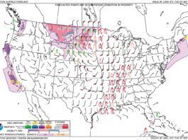
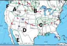
Prognostic charts (progs) rank among the most used weather charts in aviation. Progs are published four times a day and provide a comprehensive overview of weather across the United States out to 24 hours. Theyre found many places, but the source is the NOAA Aviation Weather Center website under Forecasts > Prog Charts > Low Level. There is also a separate chart set under the Surface tab that ranges out to 8 days in the future, but there are no precipitation markings after 48 hours.
Readback: August 2015
While I was working on my instrument rating, I sought advice from a number of sources. One group of pilot friends said that with an instrument rating-or even now, to get in the habit-I should file/follow Victor airways. Another group says Why? No need to follow land-based navaids; just file direct.
Want RNAV with that?
Back when Southwest Airlines was the upstart operating out of airports nearby major cities rather than in them, everyone in New England knew about Manchester Airport (KMHT). They even call it the Boston-Manchester Airport, even though it was an hours drive away in a different state. Now Southwest flies to Bostons Logan Airport, and KMHT is more a sleepy reliever field. However, its still an aviation trendsetter, and this trend is open to anyone looking for more efficiency.
WX Briefing Hot Words
I used to get occasional in-person briefings when I lived in the Emerald City. Thatd be Seattle, Wash., not somewhere in Oz, but it might as well have been a fairy tale for all it matters now. Before the mid-80s there were over 350 FSSs around the country. Unless youre in Alaska, thats all gone. Flight Service (run by LockMart under contract) briefs over the phone-if you bother to call at all.Thats a real loss, because I always learned something in those one-on-one briefings. The briefer would point to a Prog chart showing low pressure moving into British Columbia: Now this looks like its gonna roll right through the south tip of Vancouver Island. If that happens, the winds will be blowing like stink when you try to get back here tomorrow. Youll have great groundspeed, but landing could be tricky ...
Hocus Focus in Vermont
Tucked in a seam between the Green and Taconic Mountains, with the Adirondacks just to the west across the Champlain Valley, Rutland-Southern Vermont Regional Airport (KRUT) serves a variety of aircraft from biz jets to homebuilts. The appeal of Vermont scenery and skiing tempts vacationers into Rutland despite the surrounding hills.
No Initial Fix Needed
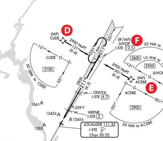
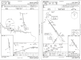
Back when I used to teach science classes for elementary school students and their teachers, we used to say that a great question was one that generated an answer plus two more questions. Such it is with the RNAV (GPS) Rwy 33 approach to Easton, Md.
Spreading The Word Via The Strip
Ground Delay Program and EDCT Program notices are transmitted to ATC facilities in a format that tells the receiving facility the type of program, the reason for the program, and when they should receive an update.
ATCs Traffic Monitoring In Pretty Pictures Or Text
With time travel still being science fiction and all, there arent many options for predicting the future. That hasnt stopped the government from doing their best to create software tools to do just that.
Whats Changed Here?
With so many sources for PDF versions of government approach plates, available on the internet, its easy to get a quick book of approaches for your local area. People who need just a chart or two usually click the link on AOPAs web tool or Fltplan.com and print the chart.
Flying With Expired Data
I was thrilled when the first LORAN with waypoint databases made life ever so much easier and, ultimately, safer through improved situational awareness. But it came at a cost to keep the data current, and all of us pilots have objected to the cost from day one. As a result, many pilots choose to fly without the latest digital data.
Whats Legal When Obsolete?
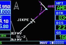
There are two aspects to the legality of obsolete data: navigation and information. The legality of using obsolete data for navigation can be found in your Flight Manual Supplement. The Limitations section of the Garmin 530W Flight Manual Supplement simply states IFR en route and terminal navigation is prohibited unless the pilot verifies the currency of the database or verifies each selected waypoint for accuracy by reference to current approved data.

