Traffic Jam in Iowa
Among the caveats, though, is the fact that the guaranteed traffic separation works great with IFR aircraft, but not so much with VFR aircraft. On top of that, even those who always fly IFR must be in VFR mode at certain times, e.g. to depart and pick up a clearance, or to cancel IFR at or before the final landing phase. Even if you had those protections all the way in, though, you could be left to your own devices if VFR traffic conflicts occur. And they do.
Spring Break
Naturally, you want blue skies and full sun to get the most out of such a trip. Theres usually no issue with that, but the Gulf region and Florida Keys have their share of showers and thunderstorms. Hurricanes and tropical storms not withstanding, weather here is dynamic, so youre going to start familiarizing yourself with this new territory early. Little do you know that its the mapping, not the weather, that will catch you by surprise.
Land of a Midnight Sim
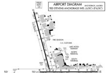
One of simulations greatest strengths is flying parts of the world where you might never make it in person. Alaska calls to the hearts of many a pilot, so well take you there today. Nothing too strenuous: Just a jaunt from Anchorage (PANC) down south to Seward (PAWD) on the ocean and then over to Kenai (PAEN) on Cook Inlet. Yeah, ICAO Alaskan airports start with a P not a K. Hmm... if you put the I-meaning you-in PANC you get Panic. Coincidence?
Circling Uncertainty
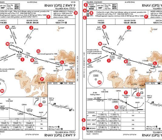
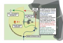
Your home field is non-towered, and the AWOS says the winds are fierce out of the west. If it was VFR, Runway 27 would rock. However, theres nasty precipitation starting five miles east of the airport. The RNAV 27 approach would drive you right through it. Youve already been beaten up enough for one day. Instead, the reported 800 foot ceiling inspires you request an RNAV approach to Runway 36 with a circle to Runway 27. The circling mins are 600 feet for your aircraft category. Youll stay close to the airport and once you get underneath, you can bring it around to land into the wind on 27.
Uncontrolled IFR
Operations take place daily in uncontrolled airspace. Paynesville, MN (KPEX) is a typical non-towered airport with the familiar vignette depicting Class E beginning at 700 feet AGL. Departing Paynesville, any time we spend in the clouds below the Class E floor is IFR in uncontrolled airspace. Of course, as you should recall, lacking that magenta vignette, the 700-foot limit becomes 1200 feet. Instrument approaches begin with an ATC clearance in controlled airspace, but often take us into uncontrolled Class G airspace. At Paynesville, the RNAV (GPS) RWY 11 approach LPV mins take us to 200 feet AGL, 500 feet into the surface Class G airspace.
Party in the Pattern
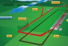
Likely you either practice approaches to non-towered airports or fly into airfields with part-time control towers. Non-towered airports, hotbeds of GA activities, present our greatest risk of a midair collision; a risk mitigated by a disciplined adherence to procedures (proper entry into landing patterns, proper departure patterns) and proper use of the UNICOM frequency at uncontrolled airports. (FAA Aviation News, May/June 2001) Therefore, its important that instrument pilots play nice around the pattern. The updated AC 90-66 covering non-towered airports specifically identifies instrument pilots, maybe because of some past misbehavior.
Up In Upper Michigan
For those unfamiliar, the Upper Peninsula of Michigan boasts generous lengths of shoreline off Lake Superior, scenic byways, and lots of trees. While it can be a winter wonderland during the off-season, its not unusual to have many days of dreary gray skies and fog that wears away the most sanguine spirit. Its the kind of weather that gets us burning through a whole morning figuring out how to get out, around and back without getting stuck who-knows-where. Welcome to the UP.
A Stability Refresher
While stability and instability dont always cause weather, they leave a mark on even VFR forecasts in many subtle ways, and they influence everything from wind gusts to cloud layers. Even in forecast models, there are always complex equations that factor in stability. Stability is important enough that an entire chapter is dedicated to it in the FAAs Aviation Meteorology circular. For meteorologists, a chart known as the Skew-T diagram is used every day at forecast centers. Its literally a worksheet that helps forecasters visualize the days stability and make calculations on it.
Depart Midway, Again
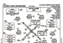
Our February 2018 clinic (Chicagos Scenic Route) discussing a particular procedure at Chicago Midway International led to some reader mail about what should happen. The Midway Three departure for Runways 4L and 4R, if interpreted on its face, would have indeed involved extra maneuvering just after takeoff, as we discussed. It has since been noted that this DP calls for a more logical sequence of steps to make it work. So we went back to take another look at the Midway Three along with the other DPs published there. The charts have since been updated a little to clarify when, where, and how high to go.
Exploring Every Angle
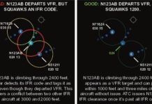
What happens if you depart on the original IFR squawk? In a word: confusion. While, you are technically VFR-you voided your clearance by departing VFR-ATCs radar doesnt know that. Itll still detect that IFR squawk and tag you up on the scope as if you were on that IFR clearance. An unexpected IFR target popping up amidst their other IFR traffic is a real distraction to a controller, especially if its an aircraft who was expected to hold for release.
Overlay Approaches
Lets connect some dots. In 1969, NARCO (now defunct) introduced the CLC-60 VORTAC Offset Control Panel that allowed navigation to a phantom fix defined as a distance and direction (rho-theta) from an existing VORTAC. It was touted as the first RNAV system. In the 80s, Bendix/Kings KNS-80 Integrated Navigation System might be considered the first practical RNAV navigator (it had VOR, LOC, DME, RNAV, and GS). Like the CLC-60, it could electronically move a VORTAC and was IFR certified.
CFTT Precedes CFIT
IFR separation from other aircraft is well-understood in our community. Within the controller community there is something additional called terrain separation. A loss of terrain separation occurs when an aircraft enters a chunk of airspace at an altitude below the prescribed minimums. Minimum vectoring (or instrument) altitudes arent published, so initially theyre the controllers responsibility. Busting either is CFTT, but they are not the sole province of ATC. Pilots also cause CFTTs. Lets look in our own house first.

