Access to Asheville
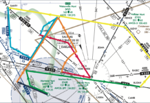
When you were seven, your mother sent your father to the store for milk, and he came back three years later—but only because he...
Near-Miss Understandings
Sequences don’t come much easier. A VFR Mooney and a VFR Cherokee both requested a practice RNAV approach. They were the same distance from...
Skew-T Simplified, Pt. 2
Last month, we took a close look at Skew-T (sounding) diagrams and how they’re constructed. To refresh your memory, Skew-T’s are simply diagrams showing...
LOAs: Tribal Knowledge
One of the ways the FAA manages many things without creating new regulations is through Letters of Agreement (LOAs). There are many types of...
How We Die, Part 1
(This is the first of a four-part series of articles in which contributing editor Fred Simonds will fully explore common, oft-fatal mistakes that we...
ILS on the Block
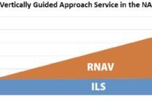
In 2015, the FAA began looking to rationalize ILS approaches. In this context, rationalize means cut. The following year, the FAA developed a cost/benefit quantitative model and conducted an analysis at about 2900 airports with few or no RNAV SIDs or STARs. The finished product was a plan to decommission Cat I ILS approaches at some of these airports between 2020-2030. Before a decision was reached, the project was shelved in 2017.
Choose a Shortcut
Things are getting busy approaching Trenton, Tennessee, Gibson County (KTGC), even though its not that bad. But the skies are grey enough to make you squint as you enter the overcast. Youve also entered, as youll soon find out, the murky realm of the regs. A cold crust of rime clings to the aluminum and probably the antennas, so youre anxious to get into that toasty hangar at TGC. Worse, the suns going down and the gyros acting up. So any shortcuts (safe and legal, of course) would be great right about now.
Any Ol Alternate
Pop quiz: When must you file an alternate? Thats an easy one, we all know the rule about needing 2000-3 one hour before and after the ETA. Next question: When do you file an alternate? Probably the most common answer is, I always file an alternate. Fair enough, its never a bad idea. Now, regulations aside, why do you file an alternate? Naturally the response is: In the event the weathers gone down too low at the destination and we need somewhere else to go. Right up there is an unexpected loss of equipment or a navaid required for an approach. And while the regs are also designed to provide a backup for lost communications, this often serves as a distant third, cause these days were just not all that worried about that.
BasicMed Checkup
BasicMed is the result of a legislative initiative that produced Public Law 114-190, the FAA Extension, Safety, and Security Act of 2016, signed into law on July 15, 2016. BasicMed (a term that came later) is found in Section 2307 of the law: Medical Certification of Certain Small Aircraft Pilots. This law directed the Executive Branch, through the FAA, to issue regulations within 180 days to allow pilots to act as PIC under the law. The regulations (new Part 68 and changes to Part 61 & 91) and the term, BasicMed, came into existence when the rules were published in Federal Register on January 11, 2017 and became effective on May 1, 2017. Because the law only addressed pilots acting as PIC, we have the unintended consequence that a safety pilot, not simultaneously also acting as PIC, needs an FAA Medical as a required crewmember, as weve discussed previously.
Make a Note
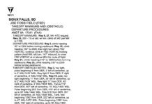
Does this meet your takeoff minimums? As a Part 91, single-engine-land flyer it can legally be as low as 0/0, but you prefer to be able to be able to make it back in if need be, plus a little margin. So use the RNAV 15 approach as the backup. But wait: Youre LNAV only, no vertical navigation, so your MDA is 1920 feet with one-mile visibility. This is nearly 100 feet higher than the current ceiling-still legal to fly under 91.175, but not a good turnback plan.
Alternate Missed
When the problem was the missed approach, my favorite tool was requesting alternate missed approach instructions. With a single ATC transmission, the requirement vanished because we werent flying that missed. At least, thats how I interpreted the regs, and the statute of limitations is past. I later realized I could even suggest my own procedure to get pointed at the IAF for the next approach. This permitted a fun game of rapid approach roulette, which is what this sim challenge is all about.
Satellite Imagery
Since the mid-1970s, satellite imagery has made its way into everything from television weathercasts to flight weather briefings. We see them constantly. When a hurricane is approaching the coast, viewers are presented with satellite images. When the local news shows the forecast, a satellite image is almost always used. This technology has grown progressively more complex and powerful over the years, and more than ever it can be a valuable part of flight planning. Lets examine some of the basics of the technology and look at todays capabilities.

