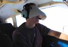
A Visual in IMC
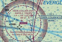
Let's consider a situation. We are flying over the Florida Everglades in low IMC. Our alternator just died, which clearly counts as an emergency in IMC. So, we must land. Now! Wind is blowing from the west at 25 knots and we are close to Dade-Collier Transition and Training Airport (KTNT). Although it used to have three approaches to Runway 9-an ILS, an NDB and an RNAV-the only one now available is the RNAV (GPS) RWY 9 approach. With that wind, we certainly will not be landing on Runway 9, even though the runway is 10,500-feet long.
Good Plan Gone Awry
Time to check Off-Route Obstruction Clearance Altitudes. These start at 3400 to 4000 feet then quickly get up to 6000. The terrain continues to rise towards 8000 feet past Scottsbluff. Uh, were not in Minnesota anymore. OROCAs, as defined by the Instrument Procedures Handbook, are for situational awareness and emergency use. While OROCAs provide standard obstacle clearance margins (1000 feet in non-mountainous areas), you cant count on them. You decide its safest to file for 8000 feet.
Going Around Weather
We all have a different way to go about our flight planning, but most of it is along the lines of where to go, how high, how much fuel, weight and balance, etc. You factor it all into the plan, but at some point youll add that X for some bad weather and a re-route. Maybe the weather is fine where you are departing but not good where you are going, or vice versa. Depending on the mission, what are your options? It all comes down to a go/no-go on what youre comfortable doing and not doing. This is the typical process regardless of whether youre filing VFR or IFR.
Sneak in the Side Door
Before you get a contact approach, some more boxes need to be checked, starting with weather minimums on par with Special VFR and Class G airspace. AIM 5-4-25 kicks off with them: Pilots operating in accordance with an IFR flight plan, provided they are clear of clouds and have at least one mile flight visibility and can reasonably expect to continue to the destination airport in those conditions, may request ATC authorization for a contact approach.
Route Planning
This is a long flight, so you want to minimize distance and go as direct as possible. You scan the route from TAFOY to KFSM on the chart, and it doesnt pass through any special use airspace (SUA), so you could go direct. But, you want to comply with the AIM guidance (see below) and pick a fix or two in each centers airspace. You zoom in on the chart to see TAFOY clearly, then just scroll the chart to the east along your route, looking for fixes on your route that you could add.
Accidents: AA 1420
One of the last weather-caused airline crashes in the United States was American Airlines Flight 1420 in Little Rock on June 1, 1999. As we mark its 20th anniversary, well tie together some of the radar and thunderstorm skills weve learned in previous articles. Youll also see brand-new radar scans of the storm from modern high-resolution display software-which is far more detailed than that in the NTSB report-and well contemplate what you might see if you encounter a similar storm on modern radar today.
(Always) Learning
Clearly, this was a humbling experience. Im left wondering how many of us who are more than a few decades and a few thousand hours past flying trainers at 60 knots would do better. Your takeaway from this self-deprecating story is that no matter what you fly, youve got to play well with all the others, be they fast or slow, pro or student. Im glad I relearned that lesson with no worse than some personal embarrassment. And, the students probably learned to watch out for fast twins with inattentive pilots.
How Far Can You Go?
If issued an en-route clearance limit, you will be given holding instructions. If the pattern is charted, and they rarely are, you might be issued, Hold east as published. Most moving map displays such as the G1000 and GTN series do not show published holds, necessitating a chart, but ATC will issue full holding instructions if requested. The FAA frowns on unpublished holds, saying that only those holding patterns depicted on U.S. government or commercially produced charts which meet FAA requirements should be used. This is another reason why rolling your own at JIDUK, is a shaky idea.
Hear Back, Read Back
Lets start out with a few simple examples and work our way up. One of the most-used examples is, Tower, Cessna 12345, ready for departure, Runway 14L. Cessna 12345, Tower, hold short Runway 14L. The caution below appears on many charts, but have you really assimilated what its telling you? Its simple. Essentially, if the controller says the word runway you should read back the explicit instruction: Cessna 12345, holding short Runway 14L. This is the proper way to respond.
Spring Break
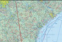
Naturally, you want blue skies and full sun to get the most out of such a trip. Theres usually no issue with that, but the Gulf region and Florida Keys have their share of showers and thunderstorms. Hurricanes and tropical storms not withstanding, weather here is dynamic, so youre going to start familiarizing yourself with this new territory early. Little do you know that its the mapping, not the weather, that will catch you by surprise.
Dissecting T-Storms
A fter a record winter where temperatures fell below -30 degrees F in some parts of the Midwest, its hard to believe summer is approaching again. That means a rapid increase in thunderstorm activity across the country. In this issue our goal is to help you not only understand the parts of a storm but also whats going on underneath the hood and what it means for the forecast. The information also might help save your bacon when things go downhill unexpectedly and all the data you have is whats out the window.
BasicMed Safety Pilot
When we got BasicMed, something wed done for a long time was taken away. BasicMed applies to acting as pilot in command. But, with BasicMed youre not legal to act as a safety pilot for your buddy whos under the hood practicing approaches in VMC. So, you exercise the workaround of agreeing ahead of time that you, the safety pilot, are indeed the PIC for this flight (more on that in a moment), then youre once again good to go even with BasicMed ... if, that is, the aircraft insurance agrees. Lets look more carefully at all this.

