
My goal in this column is to bring the art and science of forecasting to pilots. This is because forecasts aren’t perfect and still won’t be in the foreseeable future. This is not an indictment of the profession, but an acknowledgement of the realities of the forecast problem. For example, a single balloon launch is used to represent the 400,000 cubic miles of troposphere over Arkansas, and only happens every 12 hours. This is why good forecasters are skeptical of models and blend them with experience, intuition, and their own analysis before making a forecast.
Tim Vasquez
While pilots needn’t be meteorologists, they certainly can make well-grounded, educated decisions, filling in the blanks as necessary. Recognizing weather issues before they become problems should be part of situational awareness, and having an educated idea about what you’ll encounter ahead improves your safety margin. IFR readers step up to the challenge of flying in difficult weather, so every shred of safe weather-flying knowledge counts.
Yup, Size Matters
It helps to understand the atmosphere as an array of different scales. At the synoptic scale, we evaluate days and thousands of miles. For example, the Northeast U.S. blizzard of January 2016 was well advertised days in advance, and this system had a life cycle of many days and measured about a thousand miles across. Forecasters and computer models normally do an outstanding job with the synoptic scale out to about five days.
Moving down to the range of hours and hundreds of miles is the mesoscale. A good example is a squall line—measuring perhaps 300 miles long and lasting maybe 14 hours—marching eastward through Illinois. Computer models didn’t handle these systems well until the 1990s, and even today their track record ranges from acceptable to good, so the human forecaster is most valuable here. Flight weather briefings are based on synoptic scale weather but have a mesoscale granularity.
Finally we have the microscale—the range of minutes and perhaps tens of miles or less. A single thunderstorm fits this classification. Computer models don’t handle these details, and it’s more due to a lack of dense enough data than lack of computer or modeling power. I would take on a bet that dynamic computer models will not solve the problem of fog clearing off a runway in our lifetimes, but you probably won’t collect on it until I’m in a nursing home. Researchers are working on this problem for thunderstorms, though, since radar offers such a tremendously detailed picture of water droplets, ice, wind, and particle characteristics.
Where do pilots fit in? From the ramp to the sky, they constantly observe the microscale structure of the atmosphere. This kind of observation detail has been fed back to forecasters for decades through tools like PIREPs. Icing and turbulence are actually microscale processes, but the patterns that drive them are larger-scale in nature and have the capability to create them in other places in the region, too, so these observations are valuable.
Nowcasting is the study of weather from right now out to a few hours in advance. In the early 20th century, this is where pilots excelled but forecasters suffered, mostly because the resolution of early weather data was so poor. Yet virtually all pilots of the era had a keen, almost supernatural sense for the weather, and many worked closely with forecasters and were able to tap their knowledge. Ironically the roles have changed: forecasters now are practitioners of mesoscale forecasting, while automation, ATC, and procedures tend to govern flight weather safety. It’s definitely safer, but there’s still room for improvement.
Basics
The main prerequisite for nowcasting is knowing the basics of meteorology. Most readers of this column are experts in aviation, not meteorology. Over the past few years I’ve acquainted you with patterns, weather systems, and tools to give you a better handle on the basics.
You can be confident, too, because you don’t need to be an expert to nowcast. Forecasting journals targeting operational forecasters are right now focused on problems like the relation of radar tornado signatures to ground damage, ensemble model performance, and tropical cyclone intensification prediction techniques. These things improve forecasts over the longer term but are useless to you as a nowcaster.
Where can you learn more? Back issues of IFR are recommended, of course, along with my own forecast book series. There are also Internet sites like UCAR’s MetEd and Jeff Haby’s Forecasting Hints. A few colleges like Mississippi State have high-quality distance-learning courses that offer certification and credit toward a degree program. Finally an Internet search will bring up Air Force CDC course books for meteorology that can be downloaded in their entirety.
Change in the Air
A key technique for nowcasting is recognizing when the forecast is wrong. Sometimes this is obvious, such as an airfield below minimums with a VMC forecast. Other times it’s much more subtle: a cloud layer that wasn’t supposed to be there, the appearance of TAF amendments, and even winds aloft 30 degrees different from the forecast. Reality not matching the forecast is a good signal to use an extra measure of caution and to keep tabs on your alternates.
Tim Vasquez
Another way to stay in the loop is to check the forecast discussion. These are issued several times a day by the National Weather Service offices in each state. At forecast.weather.gov, pull up a forecast and find “Forecast Discussion” in the right margin. These discussions are often more technical than you need, but you can gauge the forecast confidence and see what the forecaster is thinking. You won’t find these discussions in the TAFs or the public forums; their main audience is broadcasters and industry.
In the forecast office, we do much the same thing. I trained new forecasters and the secret of forecasting that I taught them was finding consistency between the tools. Do the processes on the surface chart match what the upper air chart suggests; do those match radar and satellite? Most important, does that agree with the forecast model? If not, it’s likely the forecaster will be spending the shift issuing TAF amendments.
Clouds and Visibility
For cloud and visibility forecasting, you usually start with a TAF. But nowcasting starts with the big picture: recognizing what kind of weather pattern exists and what normally happens for that location during that season. Obviously this depends on where you are and there’s no one-size-fits-all. But meteorological basics apply. What kind of air mass is there? Is it stable or unstable? Is the air mass changing? Will the wind pass over water; are the waters warm? Old timers at an airport often have a good feel for this and know what’s coming.
But at an unfamiliar airport, go back to those basics. Has a cold front just passed overnight? Cool air passing over warm ground leads to an unstable pattern in the lowest mile or so of the atmosphere. It’s right there in Chapter 6 of the FAA’s “Aviation Weather” book. This chapter is well worth reviewing. In an unstable regime we expect cumuliform clouds, gusty winds, and good visibility. This bumpy layer deepens as the morning wears on. Smooth air is more likely before dawn.
Tim Vasquez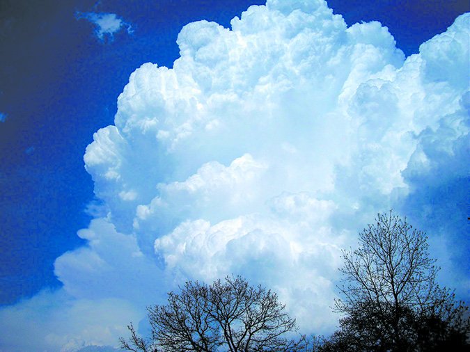
You may have heard the formula for cloud height: subtract the dewpoint from temperature (degrees F), divide by 4.5, and add 1000. This gives the height AGL of the cloud base. Note that this works only for cumulus clouds in a fair-weather pattern where the air mass is consistent from the ground up. It works fairly well because cumulus clouds are built from air near the surface, which rises and increases in humidity until condensation occurs. This happens at a known rate. However where you have a reading of cloud height, such as from an ASOS, use that.
And what about a cloud on the ground—fog? The perfect storm for radiation fog includes four factors: a wet ground from recent rains, a humid air mass, light winds, and clear skies. When this is expected, such as in the wake of a springtime Pacific front, be alert for the possibility of fog. Since fog is not handled well by models, on rare occasion a forecast shift may miss the potential for fog in the TAFs. So it pays to recognize the ingredients when they exist.
When that’s the case, a couple of stations early in the night with visibility sinking to five miles in mist is sometimes a good early-warning sign that fog may be coming. And if conditions are right, wind has a major influence on what happens. If air is calm, condensation tends to settle out as dew with no restriction to visibility. Likewise, if winds increase to more than 5 to 10 knots, low stratus may instead be the result. A few knots can make all the difference.
Striking at Thunderstorms
The rules from the AIM apply—you should maintain a 20 NM separation from all storms. That’s always not possible, of course, especially if you’re trapped with storms all around you, so there are a few things to keep in mind.
There is no safe part of the storm. The updraft, manifested by the cloud tower, can contain extreme turbulence and hail, while the downdraft, represented by the amorphous dark precipitation area can harbor icing, hail, and strong downbursts. The only way to be safe in a storm is with airborne radar, which shows the core of the precipitation.
Note that when flying at low altitudes near stronger storms, the lower part of updrafts will not show up on airborne radar because this part of the storm is composed entirely of cloud droplets that haven’t yet grown enough to be seen. This effect is known to forecasters as a “weak echo region.” This problem is conceivably what claimed the Dutch Fokker F-28 that broke up in 1981 in a tornado while climbing through 3000 feet; the pilots might not have seen anything, especially early in the tornado’s life cycle.
Finally, an issue we have pointed out repeatedly is that satellite weather cannot be used to thread your way through a storm, primarily because of the delays in the data. If a storm is moving at 40 mph and the product is 12 minutes old when you see it, the graphic will have an error of eight miles. Plus the storm’s shape will probably have changed. Satellite data products, however are good for the big picture.
Bumps in the Turbulence
Low-level wind shear (LLWS) alerts in the TAFs and SIGMETs aren’t the final word predicting if these hazards will happen. An unforecast thunderstorm or frontal passage can give you a 20-knot airspeed loss on the approach. All thunderstorms within several miles of an airfield should be regarded as producing LLWS. Fronts that have passed during the last couple hours can also be responsible, so a runway change should put you on guard. Roughness of terrain amplifies these effects, so if you’re flying from flatlands to hilly terrain, it might be best to add a few extra knots.
There really aren’t any good nowcasting rules for clear air turbulence (CAT). Forecasts of CAT were traditionally based on upper-air patterns and trends from PIREPs, and this is now solved mostly using tools such as the AWC Graphical Turbulence Guidance.
In both cases, the most important contributor to any type of turbulence is instability. An unstable layer at FL300 will increase the risk of clear air turbulence, while an unstable layer near the ground makes LLWS more likely. While it’s not your job to sift through sounding plots, especially in the middle of a flight, tall cumuliform towers, cirrocumulus, altocumulus castellanus, and gusts appearing on METAR reports are some reliable indicators of instability (but only for sure at the level where those phenomena are happening).
And with that I’ll pass on the most important turbulence nowcasting trick: enlist the aid of your fellow pilots. Monitor the frequency and ask for any information on bumps or airspeed losses anyone’s getting. That kind of information is better than any model we’ve got.
Tim Vasquez is a professional meteorologist in Palestine, Texas. He offers some extra weather training on his site and Youtube channel.


