
A friend of mine used to work in customer support for a simulator manufacturer. He told me the most common customer support question was: “OK, I’m sitting at the end of the runway. Now what?”
Imagine a pilot in the real world pondering an equivalent question. There you are sitting at the end of the runway, engine running, and thinking, “Hmm. What should I do with this airplane?”
Yet that’s the abyss many folks face—and turn their backs on—when trying to use a simulator for proficiency. Therefore, this article is an experiment; it’s a flight challenge. You could try it on a commercial training device or home simulator, or even “the simulator of the mind,” a.k.a., armchair flying. Take this challenge up at whatever level works best for you. Let us know what you think.
The Map
No, I don’t mean a map like you used to have folded the wrong way and three years out of date in your glove compartment. Ask a teen today what a “map” is and they’ll tell you it’s a virtual world where a game takes place. It’s the battlefield. It’s the arena where aspirants compete and crowds cheer. Right now it’s the LOC BC Rwy 17R and the ILS or LOC Rwy 35R at Grand Forks, ND.
Why an old school Localizer Back Course? Three reasons: People have been arguing about how to fly them in these pages, and it’s time to put some skin in that game; because almost any sim can fly it (no GPS required); and it’s… fun. (Cue evil laugh and ominous music.)
Just like you wouldn’t launch into IMC without at least some flight planning (and, hopefully, a clearance), don’t start your sim just yet. Study both approaches. Start in the upper left and brief them. Note not only the frequencies, but also the airport elevations. Unless you’re staff at University of North Dakota, you’ll be jumping to a spot in the U.S. you don’t know, so get familiar.
Note the altitudes and waypoints. Work through the missed approaches. Review the airport diagram, particularly the location of the VOR (hint, hint). While you’re there, check out all those helipads. Not a place to practice your prowess with a pogo stick.
You might also check for an ODP for Runway 17R.
The Setup
Now set the weather to 200 OVC and 1/2 mile visibility, with winds 140 at 15 at surface and 100 at 30 by 4000 feet. Set the altimeter to 29.82. Choose an airplane with no GPS and disable GPS position from the sim to your iPad if you use it. You will need DME, however. (Ominous music gets louder.)
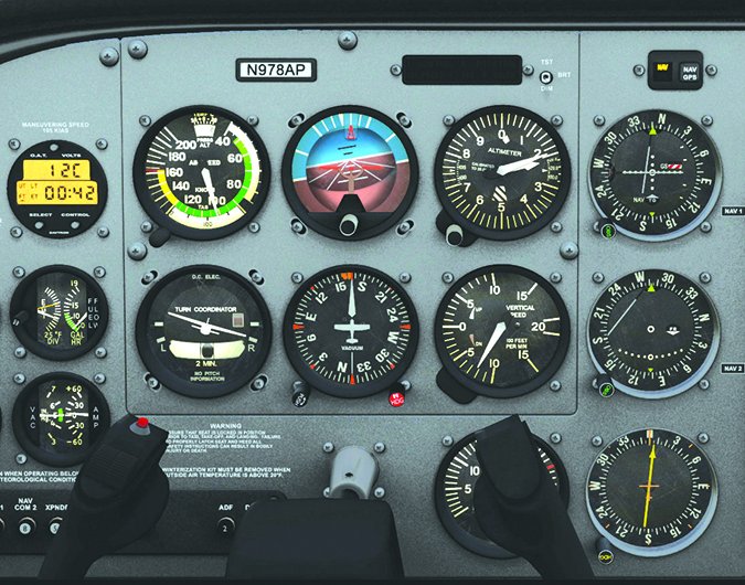
Use of an HSI is up to you; feel free to use one if that’s what you use in the real world. Don’t use one if your non-virtual bird lacks it… or you just want the extra challenge of non-intuitive needle motion.
Position your airplane on the ramp at Grand Forks if you know how. The advantage of ramp start is that it gets your mind in the right state for flight. We even suggest setting the sim for a “cold and dark” start, so you must actually hit the right switches and start the airplane before you get going.
Go through the process of finding and tuning the ATIS. Most desktop sims will play a synthetic ATIS message for you. Set up your altimeter(s) and the remaining radio frequencies: Ground, Tower, Departure. Even if you’re not talking to anyone, part of your proficiency and flow is switching from one frequency to another.
Set up all the nav frequencies you’ll use before takeoff. They can be a pain to dial in on many desktop sims, which will just frustrate you in the air. If your sim has an ADF, set that up as well for HISER. This is old-school day, and besides, NDB navigation is oft forgotten fun as well. (Evil laugh repeats.)
Taxi to hold short of Runway 17R. When you’re there, brief the challenge.
The Challenge
There are seven segments to this challenge. Those segments are depicted in the colored arrows on the approach charts on the facing page. The numbers correspond to the instructions below and the considerations in the next section.
1. You’ll depart Runway 17R at KGFK and climb direct to the hold at HISER.
2. Upon reaching 4500, turn direct to the Grand Forks VOR and hold south of the VOR on the 170 radial, 4 NM legs using DME.
3. After at least two turns in the hold, fly the published transition to MANZA.
4. From MANZA, fly the procedure turn.
5. Fly the LOC BC Rwy 17R approach to straight-in minimums.
6. With the weather at 200 OVC, you should miss the approach. If your sim doesn’t cooperate, fly the missed anyway, as published, to hold at HISER (one-minute legs).
7. Fly at least two turns in the hold, and depart the hold to fly the ILS Rwy 35L and land with that quartering tailwind.
The Flight
Feel free to just fly it now (no pausing allowed), or walk through the challenge with us first. Either way, consider the questions below.
1. Launching off 17R, you’ve got a left quartering headwind, so you’ll need correction right away. You’ll have to practice your ADF corrections, or your back course flying, to stay on course. Will you reach 4500 before HISER? At 200 feet per NM, you’d only be about 2300 MSL at HISER, but you probably have better than that, especially into the wind. If you enter the hold at HISER, which way do you turn? Which way do you turn if you reach 4500 before HISER?
2. You’ve got a significant wind to adjust for in the hold over the VOR. As a DME hold, timing isn’t essential. You’ll turn inbound when your DME distance from the VOR is 4.0. Nailing that inbound turn so you roll out right on the radial is your goal. That southeast wind will try to foil you. To that end: How much outbound wind correction do you use?
3. The leg outbound to MANZA should be an easy ride, with 900 feet to lose over 5.3 miles. Note the published transition to the left of the course. How do you navigate to MANZA? How do you identify reaching it?
4. Now you have some decisions to make. You have 1200 feet to lose and must reverse course. There is a tailwind. The procedure turn is depicted as a barb, so you can fly it however and whenever you want. How do you choose when to start the procedure turn for the BC approach? Which way will you turn (right or left) to head back inbound?
5. Time for the back course approach. Make those course corrections as small as practical on the back course inbound. You don’t have GPS groundtrack, so this is old fashion bracketing. By the time you’re FAF inbound, try to keep corrections to three degrees or less. Assuming you want to reach WUSIK at 1300 so you can just keep descending to the MDA, how fast do you descend from MANZA inbound?
6. Given how sensitive the localizer needle will be at the MAP, just fly the heading you have until the DME is counting back up past 0.5. Now continue climbing on the back course all the way to HISER. If you have an ADF, use it in the hold at HISER to help gauge your rollout to the inbound heading. It’s pointing to your holding fix the whole time. Take your time in the hold to brief the ILS. How far do you go outbound from HISER before commencing the ILS?
7. Slide down that ILS and get ready for the tailwind landing. Perhaps your sim is one of the ones that models wind shear and turbulence as winds decrease with altitude. Speaking of winds, how do you adjust your initial power settings on this ILS?
The Debrief
Hopefully you went full circle without a game-over wreck or a deviation worthy of a phone number to call in the real world. Check out the ground track and profile views for your approaches if your sim allows. How steady were you holding headings and altitudes? How smooth were your transitions. Many sims offer replays as well. These let you not only see where and how far you dipped below MDA, and but also what your attitude and power settings were when it happened.
If it went so smoothly it looked like a YouTube training video, congratulations. Next time do it partial panel. (Ominous music reaches a crescendo; evil laugh repeats even louder than music. Both fade out.) Or create a little friendly competition with a friend or two (and, maybe, a few adult beverages). Set up some random failures. Make the weather more extreme.
Whatever you do, just get on the sim and do it. That’s the most important part: actually fly something challenging. And then do it again.
There are No right Answers, But we like these
1. Left in either case. With the southeast wind, if you didn’t correct direct HISER, you probably needed to turn left to intercept R-170. But even on course, a left turn is towards the protected side of the holds at HISER and the VOR. Remember the VOR hold is right turns since we didn’t specify otherwise on an inbound course of 350 to the VOR. The inbound leg should start at DME 4.0 from GFK.
2. Four-mile legs are pretty long. You’ll need less angular correction outbound than with a one-minute hold for the same lateral distance from the inbound course.
3. The transition uses R-353 from the VOR, but practically speaking you could fly the localizer front course once you receive it and just continue on it past MANZA. Identifying MANZA is why “DME or RADAR REQUIRED” appears in the plan view; one of them is required to get from the en route environment to the IAF. MANZA is a DME distance on the localizer, not from the VOR, so you need to switch sources. It’s only about a quarter-mile difference in location, but it’s a potentially fatal mistake where the two sources are further apart. You should have somewhere in your approach briefing where you verify all nav sources are configured correctly for final approach. If you fly this with the wrong DME source, you’ll stepdown and miss a bit too soon.
4. It’s up to you so long as you stay within 10 miles of MANZA. You could start right at MANZA; you could do it has a 90-270 turn if you want. With the southeast wind, we’d turn right—into the wind—to minimize wind drifting us back onto the approach course before we were ready. That’s simpler and quicker than extending the outbound leg of the procedure turn.
5. You need to lose 324 feet per mile from MANZA to WUSIK, which is close to a typical three-degree glideslope. With the headwind component, using a glideslope-like descent method should work out nicely. No dive-and-drive needed.
6. The hold is at 2600, which is the glideslope intercept altitude. However, glideslope crossing altitude is 2536 at HISER. So you want to ensure you get established inbound far enough before HISER to comfortably start the descent. Also there’s a southeast wind slowing our outbound progress and speeding our inbound. So some extra time outbound, particularly on the outbound PT leg, will help.
7. The tailwind ILS will require a greater than normal descent rate for your indicated airspeed due to higher groundspeed. You’ll fly it with a lower power setting than no wind.
Jeff Van West recently doubled-down on his home proficiency use. If you’ve got a challenge you think will spool him up, send it our way.


