Briefing: February 2020
Harbour Air flew a De Havilland Beaver on floats on pure electric power for the first time in early December as the first step in its program to fully electrify its fleet of historic seaplanes. The Vancouver-based airline serves dozens of communities off British Columbia's west coast and most of its flights are 30 minutes or less so the company believes new advances in battery technology will enable it to safely carry out the dozens of commercial passenger flights it operates every day. The December flight was a demonstration of the motor in a plane near its gross weight with batteries and lasted about 15 minutes. CEO Greg McDougall lifted the almost-70-year-old airframe off the Fraser River and later reported that it flew like a Beaver. He said newer, lighter batteries that are becoming available will allow room for passengers and cargo and the savings on maintenance and downtime will ultimately pay off.
Readback: February 2020
I noted an interesting change to the Instrument Rating ACS released back in June last year. It used to be that per the ACS, a circling approach required a heading change of at least 90 degrees from the final approach course to the landing runway. That requirement is now gone, replaced with the requirement to Visually maneuver to a base or downwind leg appropriate for the landing runway and environmental conditions. Also, new language was added saying the pilot must not bank over 30 degrees.
The Power of Paint
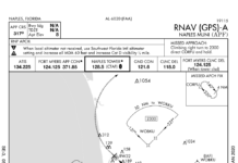
Look at the RNAV (GPS)-A approach at Naples, FL (KAPF). Seems like it is a straight-in approach to Runway 32 but it only has circling minimums. There are three conditions stated in the FAA Instrument Procedures Handbook (FAA-H-8038-16B) preventing straight-in minimums: 1) The final approach course alignment with the runway centerline exceeds 30 degrees, which isn't the case here. 2) The descent gradient is greater than 400 feet/NM from the FAF to the threshold crossing height (TCH). The actual descent gradient here is 316 feet/NM. 3) A runway is not clearly defined on the airfield. This is all that's left.
Filed vs. Cleared vs. Flown
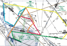
Every instrument pilot should understand the process of filing, getting a clearance, and then flying an IFR flight plan. But why does it occasionally seem that ATC makes things complicated? Say you've filed a straightforward Point A to B then C. But then you're cleared from Point A to B then to X, Y, Z, and only finally to Point C. Why are these extra fixes in the flight plan? Where did they come from? Why this today instead of an intermediate RNAV fix that you usually get?
Ida-hole Charters
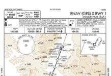
Ever wish you flew for a living? If so, think about keeping a smile on while straightening your tie as the client lambastes you that low IFR (whatever that is) didnt stop the last crew. Oh, and you stocked the treat basket with the wrong brand of bottled water. And its too warm. Consider yourself fired-but only after you get your hiney in the pilot seat and deliver them to their ski weekend in Jackson Hole.
Check Your Data
At the airport, Ill pull the airplane out of the hangar, preflight, and hop in. Once inside I get the ATIS and clearance before starting the engines. That morning Tower was still closed-Im a morning person-so in good VMC, I planned to launch VFR and pick up my clearance in the air from Center. With the engines running, I uploaded the flight plan from Pilot. Thats where the first sign of trouble popped up; my Garmin GTN 650 didnt like the flight plan from my Garmin Pilot EFB. It was fine last time. What the…
Got em On the Fish Finder
The FAA does a fine job of providing a framework for our safe flying. But, even within that, there are a few arcane things that might not make sense or might be done better. My favorite example is 91.126 that essentially says if the Class G airport has standard left traffic, When approaching to land … each pilot of an airplane must make all turns … to the left. Its difficult to argue that entering a traffic pattern isnt approaching to land, but that first turn is to the right, against the rules. (Yes, the FAA has talked around this, but it says what it says and thats not what we do.)
Backing Up GPS
The MON will remain until an advanced system emerges that can seamlessly recover from a GPS failure. Until 2014 the FAA advanced a system that provides alternate positioning, navigation, and timing (APNT) as GPS provides PNT. In 2015 APNT research was pushed into NextGens far term, 2026-2030. Once the MON is complete, the FAA plans to re-evaluate existing VORs, but at that point, APNT research will just be getting off the ground. The bottom line: some VOR navigation will be with us for years to come. Youd be well advised to keep your VOR navigation skills sharp.
TERPS 101
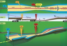
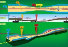
Since we trust our lives to procedures designed to TERPS standards whenever were in the soup, lets pull back the curtain just a little bit to see whats going on behind the scenes of our approach charts. Note that collectively the TERPS standards easily run over 1000 pages and often involve quite a bit of math, so this is intended to be an overview and is by no means exhaustive. We will be looking at basic concepts and how they apply to approach procedures in this article; in a future article well discuss standards for other phases of flight.
Alternate Missed
When the problem was the missed approach, my favorite tool was requesting alternate missed approach instructions. With a single ATC transmission, the requirement vanished because we werent flying that missed. At least, thats how I interpreted the regs, and the statute of limitations is past. I later realized I could even suggest my own procedure to get pointed at the IAF for the next approach. This permitted a fun game of rapid approach roulette, which is what this sim challenge is all about.
Satellite Imagery
Since the mid-1970s, satellite imagery has made its way into everything from television weathercasts to flight weather briefings. We see them constantly. When a hurricane is approaching the coast, viewers are presented with satellite images. When the local news shows the forecast, a satellite image is almost always used. This technology has grown progressively more complex and powerful over the years, and more than ever it can be a valuable part of flight planning. Lets examine some of the basics of the technology and look at todays capabilities.
Canadas ADS-B
Just to make sure you understand whats up, lets review. In the U.S., weve got excellent radar coverage, so all those radar sites have been modified to understand your aircrafts ADS-B out transmissions. In those areas where radar sites dont quite have adequate coverage, the FAA has added ground stations specifically to receive your ADS-B Out. The bottom line is that the FAA has sufficient ground-based coverage to know where you are almost all the time, using your ADS-B Out.


