
Photo by the Author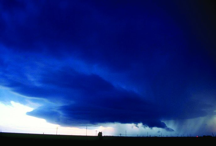
In today’s age of accurate forecasts and effective detection, it’s easy to avoid thunderstorms. However, with tight schedules and overconfidence leading to a failure to exercise proper thunderstorm avoidance, thunderstorms remain a significant cause of aviation accidents, with wind shear often playing a leading role. A recent memo by Airbus stated that wind shear is involved in four percent of approach and landing accidents and is the ninth leading cause of fatalities.
Not surprisingly, the latest thunderstorm-related accident published in the NTSB’s listings reads, “The instructor noted that the reported winds were from 260 degrees at 10 knots. She continued the [Cessna 172’s] approach normally; however, during the landing flare a significant change in headwind caused the airplane to climb. The flight instructor added engine power and pitched up, with the intention of aborting the landing; however, the airplane quickly descended uncontrollably onto the runway. The airplane landed hard and sustained substantial damage to the left wing.”
Clearly thunderstorms still represent a danger we should learn. Even with proper planning, there will come a day when you’ll find thunderstorms springing up during your flight with cells camped out near your destination. Do you have a plan? Do you know how to recognize the hazards and get the plane safely on the ground?
To help you with all of this, we’ll take a look at thunderstorms and on staying safe, all from the perspective of an aviation forecaster.
Photo by the AuthorNASA/ Goddard Space Flight Center Photo
The Basics
It’s better to have a working knowledge of thunderstorms to put safety rules into context. Understanding the storm gives you insight and situational awareness—a foundation of safe flight through the ability to make a fully informed decision.
A thunderstorm is the result of a large updraft of warm, buoyant air that ascends through the troposphere. But it’s not just any buoyant plume, as such a description also applies to fair-weather thermals. The thunderstorm plume contains an abundance of moisture. Once condensation occurs (How? Through cooling to dew point as the plume ascends.), visible cloud material appears, and not only do we get precipitation and potential icing but also latent heat, which increases the thermal’s buoyancy. This plume of warm, buoyant air initially appears as a vigorous cumulus cloud, but soon grows vertically into a cumulonimbus, towering into the upper troposphere. The air feeding into this updraft is called inflow.
The other half of the storm is the downdraft. Massive condensation in the updraft produces cloud droplets and precipitation particles—rain, ice crystals, graupel, even hail. It’s been estimated that in an ordinary storm, the precipitation load weighs just over a million tons. All this precipitation begins falling. As it does, it chills the air through evaporative cooling and also drags the air to the surface mechanically, producing a downdraft column. This reaches the ground, sometimes at great speeds. Once it reaches the ground, it spreads out horizontally producing what is known as outflow.
Types of Storms
When flying, you most often encounter weak clusters of disorganized-looking storms, made up of numerous small, weak updrafts and downdrafts. These storms have traditionally been given the nickname of “air mass thunderstorms” but forecasters prefer describing them as “multicell clusters.” If the winds aloft are strong, storms may aggregate into a “multicell line,” with the worst weather focusing in one specific area of the storm.
If there’s strong instability and clockwise turning of the wind with height in the lowest mile of the atmosphere, the environment is ripe for supercells. These have a rather simple definition: they’re rotating storms, and while they can contain a tornado, the vast majority do not.
They’re surprisingly common during spring and can be embedded in larger lines of storms. You may have seen many of them without realizing it. If you have access to airborne radar or radar imagery from satellite weather, these systems will have a distinct curved “V” or swirled appearance, occasionally with a so-called “hook echo” which might be associated with a tornado in the strongest supercells.
The bulk of the cumulonimbus cloud is visually unmistakable. It will show a distinct corkscrewed shape from the lower to the upper troposphere. This shape is a warning that serious stuff is going on beneath the cloud. Other signs of a supercell are rock-hard “knuckles” on the anvil’s south and west side and a prominent overshooting top above the anvil that shows sharply defined edges. Whether or not supercells contain a tornado, they always contain strong shear and a heightened risk of weather hazards. Avoid them.
If the boundary at the surface has a strong temperature contrast and the upper-level winds are roughly parallel to the boundary, there will be a strong tendency for storms to develop into a squall line, which is essentially a linear storm that has more of a two-dimensional structure. (.e. A cross section along one part of it will look like the cross section in another part.) The squall line has a very unusual structure compared to other types of storms; in about 95 percent of them, the updraft will be found on the leading edge of the squall line. As the updraft passes, the downdraft then follows, containing the precipitation and high winds.
Although the updraft contains very high velocities, the inflow feeding it is rather benign and few hazards are found here. However, the storm is approaching, and you have to be alert to where the outflow is occurring as its arrival heralds the first major hazard—wind shear. This is quickly followed by degraded visibility and ceilings and hail as the main storm arrives. In stronger squall lines, brief “spinups” called gustnadoes often occur along the outflow boundary, and they’ll appear as brief, tornado-like dust clouds. Signatures like these can alert you to where the outflow boundary is located.
Now that we have the basics covered, let’s review some of the hazards from an aviation meteorology perspective.
Lightning
Fortunately an airplane offers you plenty of protection from a lightning strike, but the strikes can cause equipment failures and contribute to disorientation at night. Modern microprocessor-based avionics can be vulnerable to static damage from a close lightning strike. You may want backup devices ready in case the main systems go offline.
The greatest density of strikes is found within the precipitation core (roughly correlating to the highest intensities seen in radar imagery) between a height of roughly 10,000 and 25,000 feet. This is because lightning formation is closely tied to the production of ice crystals. Flight level temperatures of +5 to -5 degrees C signify a heightened likelihood of a lightning strike. Also lightning is clustered in the precipitation area, so strong radar returns indicate a high risk of lightning. However, there is no truly safe spot in the storm and even cloud-to-air strikes may occur, so confidently avoiding the lightning means observing the 20-mile avoidance rule.
Precipitation and Icing
Heavy thunderstorms produce large amounts of precipitation, which can overwhelm turbine engines to the point of flameout. Storms in subtropical and tropical regions notoriously produce high precipitation densities. Fortunately ground and airborne radar, Stormscopes, and Strikefinders are excellent for showing areas correlated with high water loading in a storm since they identify signatures that are caused by precipitation or the associated friction-based static discharges.
Icing is a major hazard in thunderstorms because of the tremendous amount of large supercooled drops in a storm. However the actual risk to aviation is minimized because the icing is concentrated in specific thermal layers within the storm (0 to -20 degrees C), which will remain at consistent altitudes even in the strongest of storms. Stay in temperatures above freezing or below -20 degrees C and you’re generally safe. On an ordinary spring or summer day, this layer will normally be found between 10,000 and 25,000 feet, but things can get a lot more complicated in winter weather scenarios where safe thunderstorm flight levels are in a very narrow band.
Hail
For those with airborne radar, hail is an incredibly good reflector and it’s unlikely that the radar will miss the spots where it’s occurring. However hail produces significant attenuation of the radar signal, giving the impression that there’s only weak precipitation on the other side of the depicted hail shaft. The highly efficient scattering of wet hail can also produce spikes and other misleading signatures as the radar energy travels from the hailstones to the ground and back again. Caution is still warranted when interpreting the radar display.
Even with airborne radar in capable hands, hail shafts can deliver a surprise, as in the case of an Air Transat L-1011 that was heavily damaged over France in July 2001. It’s worth noting that the French BEA accident report stated “the crew chose to avoid the worst area of the thunderstorm as depicted and flew through another area, the color representation of which did not show activity.” Fortunately the plane landed safely and all 208 on board were unharmed, but it was not economical to repair the airframe and it was written off.
The most likely explanation is not that the hail was invisible to radar but rather that the plane flew into a clear area that was suddenly filled with hail from above. A three-inch hailstone falls at about 107 mph. Hail is often thrown out of the updraft unpredictably and unexpectedly, and storm chasers have long observed instances of fuzz around storm anvils where thunderstorms throw hailstones out into clear blue sky—another good reason for the 20-mile rule.
Intense Vertical Velocities
The strongest vertical velocities are normally found in the updraft portion of the storm, within the cumulonimbus cloud, not the precipitation shaft. The speed of updrafts here is directly tied to the instability within the atmosphere. Experimental doppler radars have shown updraft speeds as high as 15,000 fpm, but a more typical speed for an ordinary storm is 2000 fpm. Likewise downdraft figures average 1000 to 2000 fpm but can be well over 4000 fpm, near the meteorological 20 m/s threshold for downbursts. Few aircraft can climb or controllably descend at those maximum rates.
And here we get into airframe damage. Intense changes in wind over short scales of distance and time are the root cause of weather-related inflight breakups. The most dangerous area in a thunderstorm is the so-called “shear zone”—the region between the storm’s updraft and downdraft. It is here where a transition occurs between strongly opposing vertical velocities, with the strong shear zone shedding numerous small vortices that are felt as intense turbulence. This shear zone normally measures a few miles wide, but in severe storms can tighten down to a scale of hundreds of meters. Clearly flying through this zone is not only rough but has the potential to deliver catastrophic G-forces causing an unfortunate end to the flight.
Photo by the Author
Wind Shear
As discussed earlier, wind shear is perhaps the biggest risk of all and is responsible for many recent NTSB accident reports associated with thunderstorms. The techniques for dealing with wind shear are mostly situational, but it boils down to awareness—being aware of thunderstorm structure, knowing how to visually identify the downdraft and developing rain cores, and knowing the relationship of your aircraft to these areas in terms of the airspeed changes they may bring.
When approaching a terminal area with storms nearby, try to build a picture of the basic wind flow at and near the airfield. Check the weather report for winds, and relate that to the storm’s location. If winds are blowing away from the precipitation core, you can presume that the airfield is immersed in thunderstorm outflow.
This outflow is normally a few hundred feet deep, so at some point during the approach you may lose or gain some extra speed and have to correct. The threat during the landing phase will mostly be in terms of gusts, crosswind, and perhaps some low-level turbulence.
If airfield winds are blowing toward the precipitation core or are light and variable, outflow is not affecting the airfield. Except for gusty winds, there will be no problems during your approach and landing unless outflow air suddenly arrives—that is, as long as there’s not a change in wind direction.
Where is the outflow? Start with the precipitation core and visually work your way outward. The biggest sign of its presence is blowing dust and debris. Also you may see flags that are pointed away from the precipitation. If you spot this, you can presume to have found the outflow and that it is moving outward from the precipitation shaft. If these signatures are occurring close to the airfield, you should assume a significant risk of low level wind shear and prepare accordingly or proceed to an alternate.
Finally, this is not often mentioned, but be sure to check the cloud base above your anticipated flight track, as there may be a new downdraft developing overhead. If you can easily see distinct cloud features, you’re in the clear. A fuzzy, indistinguishable cloud base, large fat drops on the windshield, and a rapid increase in lightning strikes around you are sure signs that a downdraft, possibly even a downburst, is on its way to the ground. This is one of those situations where quick thinking and a missed approach guarantees your days of flying will continue.
Tim Vasquez is a professional meteorologist in Palestine, Texas. See his website at www.weathergraphics.com. He’ll gladly exchange some of his perspective for some of yours. Any pilots in east Texas want some weather assistance?


