

If you think summer weather in the southeastern states means sunshine and VFR, you probably haven’t experienced one of the numerous warm-season ground stops on traffic going to Atlanta. Granted this part of the country gets plenty of blue sky, but it’s also when the region gets the bulk of its precipitation. Furthermore some readers might have noticed weather charts almost never show fronts in this area during the summer. So how can we truly get a handle on what to expect?
Most of the time when you’re dealing with preflight weather briefings and TAFs, you only see half the picture: the final forecast. Very few pilots actually get to see the thinking that goes into the predictions. It’s my job to give you that.
By showing you the details of forecasting in the southeast United States, you’ll be able to fly into the region with confidence and a much more meaningful picture than just reading the SIGMETS and seeing the familiar VCSH in the METARs and TAFs. As we’ve said all too often, a good forecast in combination with insight into the situation is your key to situational awareness.
The Bermuda High
To understand what is happening in places like Pensacola and Raleigh in August, we need to look at the big picture first. During the summer months, the relatively cool oceanic high pressure areas become dominant across the hemisphere. These are some of the largest systems ever encountered in meteorology. The Pacific high can reach up to 8000 miles in width, while the Atlantic system known as the Bermuda High (not a John Denver song) can span up to 5000 miles of the western hemisphere.
Weather within the central and western core of an oceanic high is usually excellent with plenty of VMC. But the United States is rarely in the core, instead seeing the western fringes of the Bermuda high. The clockwise circulation assures a persistent southeasterly wind here, and is broken only by localized circulations and the rare appearance of Canadian fronts.
Air within the Bermuda High is comprised mostly of warm, moist “maritime tropical air.” Visibility is usually five to 15 nm in this air, obscured slightly because of abundant condensation nuclei and high relative humidity. Visibilities are lower where man-made pollutants add particulates to the air. Some areas of exceptionally good visibility will also develop in the upper levels of the Bermuda High wherever subsidence is taking place.
Predictable Storms
Summertime in the southeast U.S. is characterized by strongly diurnal thunderstorm activity. Since the 1940s these summertime storms have been known by their misnomer “air mass thunderstorms,” suggesting that they just randomly appear anywhere within the warm, humid maritime tropical air. But the situation is actually a lot more complicated than that.
The very weak mid-level capping and abundant moisture means numerous thunderstorms develop preferentially wherever weak-wind convergence and sufficient moisture are found. The trick is finding it, and that’s something that today’s forecasters are fairly good at, using tools like the dense ASOS network and high-resolution satellite data. Even an experienced pilot who uses the tools regularly can guess where these storms might later develop.
Of course, there are geographic locations that favor thunderstorm development. One is found along the tail of the Appalachian Mountains, extending from the Asheville area to north of Atlanta and Birmingham, almost to Columbus, Mississippi. These mountains range anywhere from 2000 to 5000 feet MSL, and given the generous moisture, strong heating, and mountain circulations, are often the first locations to produce storms in this area.
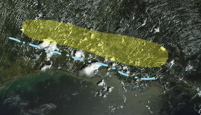
And finally a dynamic but predictable source of convergence is the sea breeze boundaries, which form along the Gulf and Atlantic coasts at daybreak and rapidly move inland. These are potent sources of lift, and it means that if you’re flying to an airport that’s 50-100 miles inland, you run a risk of seeing thunderstorms during the afternoon as the sea breeze arrives. The daily oscillation of the sea breeze is influenced by the large-scale pattern, such as the flow of the Bermuda High, and is easily disrupted by any fronts or thunderstorm complexes that already exist in the area. It’s the dominant factor when the day starts out VMC.
Storms: What to Expect
Most of these storms develop around midday and dissipate by late evening, usually making your best flying weather between midnight and noon. The storms usually drift with the mean tropospheric flow—the average of all the wind vectors from the surface up to about 40,000-50,000 feet. Nocturnal thunderstorms occasionally occur off the Atlantic and Gulf coasts and may briefly affect terminals if the steering flow happens to brings them onshore by sunrise. These storms normally dissipate by 10 a.m.
Sometimes areas of broken storm coverage may be hundreds of miles deep. Be critical of airborne radar, as short-wave attenuation may not give you the full depth of a cell. You’ll get more reliable images from the XM Weather and ADS-B broadcasts, as these use ground-based weather radars that are more powerful and operate on longer wavelengths, plus the images are often mosaics of multiple sites. Though you can’t predict the behavior of individual storm cells, these products are excellent for helping you gauge the overall size and coverage of these storm areas to find safe passage.
In a classic southeastern U.S. summer pattern, storms bring little in the way of severe weather. Wind gusts seldom exceed 30 knots, and 15- to 20-knot gusts are usually the norm. Hail is rare due to the high freezing levels and high wet-bulb temperatures, and tornadoes are extremely rare due to the weak wind profiles, though weak waterspouts are occasionally observed in coastal areas and yield no meaningful information on storm strength. The biggest threat is clear icing within storms—easily avoided by a change in altitude—and low-level wind shear around storms.
On the ground, lightning is an underestimated danger to pilots. These storms are prolific lightning producers and the ramp is a wide open space.
Beware the Deep Tropics
As the summer wears on, the deep tropical easterlies expand northward from the southern Gulf of Mexico into the southern states. By “easterlies” we mean the east-to-west component in the winds-aloft charts, which is seen mostly above 10,000 feet but often extends to the surface. Typically by August, a good chunk of the Dixie states are under easterly flow.
As this easterly flow deepens, the region increasingly gets its weather from the tail end of disturbances that are embedded in this flow. These are easterly waves and are sometimes referred to as “inverted troughs,” since they are strongest deep in the tropics and weakest at their poleward tips. These troughs drift westward at about 10-15 knots, advancing about 250-300 miles a day. They’re only weakly detected in surface data and are most commonly tracked by forecasters using satellite loops. The waves help enhance thunderstorm activity and increase the risk of rain.
Tropical storms and hurricanes are exceptional examples of easterly-wave disturbances. These normally originate from the tropical Atlantic waters and move slowly northwestward into the southeast United States. They are most common in August and September. Fortunately these systems are well forecast and easy to avoid with proper planning. Since flying through these systems is universally dumb, we’ll leave the flying tips for them to the Hurricane Hunters.
Even after these systems come onshore and move across the eastern United States, IMC is possible but should still be avoided. The dangerous winds rapidly dissipate after the storm reaches a few hundred miles inland, but there can be extensive IMC, torrential rains—that in this forecaster’s experience tend to be even worse than forecast—and contain organized thunderstorm cells that can be difficult to dodge. It’s best to go well around these systems or wait them out.
Trouble in the Cold Fronts
At the opposite end of the spectrum, the deep easterlies sometimes gain only a weak foothold on the southeastern states. This is especially common early in the season. At such times, winds-aloft charts will show a pattern of “active westerlies” during the summertime, similar to that seen in the winter and spring months.
Meanwhile, polar fronts during the summer are normally found in the Great Lakes region and in New England, occasionally forming stagnant stationary fronts that bring lots of IMC to these areas for days on end. However with exceptionally strong outbreaks of cold air and a weak Bermuda High, the cold fronts on rare occasion can work their way south, past the Ohio River Valley into Tennessee and the southern states. This is when afternoon and evening conditions can seriously go downhill.
The fronts by definition are coupled with upper-level jets, which automatically means a potential for long-lived storms such as squall lines and supercells. Combined with ample moisture and instability, this means a significant potential for severe storms. Storms in this kind of pattern will almost be guaranteed to contain dangerous turbulence. Watch those alternates.
Tackling the Active Westerlies
Cold fronts that make it into the southeast United States usually do not progress into Florida or disappear off the coast, and will decay over a period of many days across Alabama, Georgia, and the Carolinas. This brings several days of IMC and poor afternoon flying weather, especially during the hours that afternoon heating is underway. A good clue for recognizing this pattern is when Aviation Weather Center charts show an east-west stationary front or trough draped across the southeastern United States—a good sign that a cold front is decaying in this area. This differs quite a bit from the normal pattern of light southerly flow and broad, convex north-to-south isobars across the southern states.
Active westerlies result in the lion’s share of airport closures and diversions in the southeast United States, and they also create hazards for aircraft in flight. An old article I stumbled across in the November 1974 issue of Flying underscores the danger in such a weather situation, where N7623N, a Bonanza V35 flying from Huntsville to Daytona Beach, flew into a July thunderstorm and broke up in turbulence over Georgia. The weather briefing looked fairly routine. No mention was made of the surface fronts, and the weather briefing only called for scattered thunderstorms along the route.
But a review of weather charts for the date showed active westerlies, a stationary front across central Georgia, and 30-knot winds aloft on the edge of an upper level jet. One might conclude the pilot treated the storms like garden-variety tropical showers, and had he truly understood the pattern that was in place he might have doubled his effort to avoid the storms.
It should also be pointed out that the northerly flow behind these weak cold fronts carries sulfates and other pollution from the Rust Belt southward, and this is a favored pattern for reducing visibilities at terminals down to three to five miles in haze. Active westerlies give us yet another reason to prepare for the possibility of IMC. Fortunately when widespread precipitation occurs, it’s very effective at scrubbing out this haze over a period of several days.
One Last Word
The southeast United States is notorious for its “clustering” of weather features, where in places like Denver and Chicago, pilots might be more accustomed to linear weather systems with high cloud bases. Pilots unfamiliar with flying in the southeast United States who are flying VMC are at great risk of unexpectedly heading into deteriorating weather. It’s all too common where navigating through these scattered and broken thunderstorm areas to find the escape route closing up around the aircraft.
Worse, cloud bases with thunderstorms in the southeastern states are commonly around 1000-3000 feet AGL. Combined with torrential rains means that you could very well enter IMC at some point as you pick your way through the storms, and you’ll need to be prepared.
Your best bet, of course, is to exercise caution and go around storm clusters rather than trying to navigate through the cells. Although airborne radar, ADS-B, XM, and Stormscope products give us a highly accurate picture of what’s ahead, even the strongest towering cumulus clouds are comprised of droplets and small ice particles that are difficult to detect with conventional radar until minutes later.
You won’t see these on radar until after 10-15 minutes when the work of coalescence and collision bears fruit and the precipitation imagery suddenly blooms to life. Plus, of course, there’s the matter of the delays inherent in all weather sources that originate outside the cockpit, making it ill-advised to make strategic routing decisions that narrowly avoid the storms.
Because of this, bear in mind that there are always some hazards around storm clusters that you will only be able to see with your eyes, and which you won’t see until the last moment. Don’t cut things too close; always err on the side of caution when you can’t see what’s going on around you.
Tim Vasquez is a professional meteorologist in Palestine, Texas. See his website at www.weathergraphics.com. He’ll gladly exchange some of his perspective for some of yours. Any pilots in the region want some weather smarts?


