Given the many things to anxiously anticipate in life, the twice-yearly AIM updates do not likely make the list. Grinding through all that turgid prose behind the update is probably even less popular than updating your Jepp charts, if you’ve ever done that.
Fear not. The intrepid staff at IFR suffered the drudgery for you and unearthed the essence of the April 3, 2014 update to find the gems that affect our IFR operations. Read this and you may go forth and commit IFR fortified with the latest information you intend to read…someday.
Identifier Identification
Many of us have a navigation system that automatically decodes Morse code identifiers. This handy feature works nicely—except when the identifier runs too fast and you have to do it manually. AIM 1-1-3 now says that it’s your responsibility to verify the ID by “conventional methods.” I’m not telling you what to do; I’m just telling you what the FAA expects. Besides, all good pilots know the entire ICAO phonetic alphabet and the Morse code anyway, right? So, no big deal, right?
X Marks the Spot
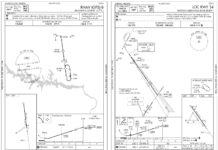
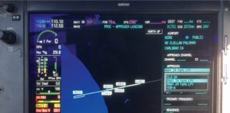
An odd little corner of GPS navigation is the ephemeral Computer Navigation Fix discussed in AIM 1-1-18. A CNF is needed to support RNAV. Therefore CNFs are unknown to ATC, not in their database and not used for any ATC purpose. They may or may not show up on FAA charts although they are defined in the Terminal Procedures Publication Legends.
Unnamed DME fixes, such as the beginning and end of DME arcs, are often CNFs. They also denote VOR, NDB or ILS FAFs on GPS-overlay approaches to mirror the ground-based approach. Advisory-only, you can’t use CNFs for direct navigation, on a flight plan or in communicating with ATC.
Adding to the fun, CNFs have five-letter unpronounceable identifiers depicted in parentheses with a small x at the fix itself. This is to increase your situational awareness and help you correlate points in your database with the chart.
The FAA plans to standardize CNF names with a CF prefix and three consonants, like CFTGL, which will appear on enroute and approach charts.
Flyover, Flyby or Both?
We know about waypoints we can fly by and circled ones we must fly over, such as holding and missed approach point fixes. Did you know some can be both?
A fly-by waypoint can be an intermediate fix for a NoPT route and also a fly-over IAF/IF hold-in-lieu of a procedure turn fix. Such waypoints will now be denoted with the less-restrictive flyby symbol. Overlay and older stand-alone GPS charts (of which only 133 remain) may not reflect this new convention.
To date, the runway threshold missed approach waypoint, normally the MAWP, could be shown as a five-letter ID or the runway number which is a real lat/long fix, not just a label. Henceforth MAWPs not actually at the threshold will have five-letter IDs. Those at the threshold will show the runway number. They’re also the center of the minimum safe altitude on most GPS approaches.
On Course…or Not?
You’ve probably noticed discrepancies between VOR and GPS navigation. Many of my students are confused by this anomaly and, if you think about it, it is somewhat disconcerting.
New in this update, AIM 1-1-18 explains why those differences occur between terrestrial and satellite navigation.
The culprit is that the sources of magnetic variation corrections vary. Each leg of a ground-based instrument procedure is initially computed by true north. Then magnetic variation is applied for the published magnetic course. A ground-based navaid procedure applies the navaid’s magnetic variation of record to get the charted magnetic course.
This sounds nice, but there’s a dirty little secret. The variation for those navaids can be decades out of date. For example, Bridgeport, Connecticut’s BDR and Chicago’s ORD VORs use values from 1965. At this late date, no one wants to pay to recalibrate obsolete VORs.
SIDs and STARs use the airport’s magnetic variation of record, which is monitored more closely, evidenced by the frequency of runway number updates.
RNAV systems correct to magnetic north by calculating variation based on aircraft position, or by applying variation from a table in their database. This difference in choice of variation reference explains why the magnetic course displayed on your moving map and the magnetic course on paper can be different.
AIM 1-1-18 goes on to say that a properly functioning RNAV system with a current, accurate navigation database should still fly the correct ground track for any loaded instrument procedure, despite differences in magnetic course attributable to magnetic variation source. The kicker is that despite the above, if “significant differences” arise, “the published approach chart, supplemented by NOTAMs, holds precedence” as always.
New Words, Same Speeds
Speed adjustment changes in AIM 4-4-12 clarify common confusion. We have a new phrase, “resume published speed,” and the AIM redefines what ATC means by “resume normal speed.”
Before an approach clearance is issued, if ATC decides that speed adjustments are no longer necessary, they will advise “resume normal speed.”
This cancels ATC-issued speed adjustments but not published restrictions, and the controller may (or not) issue “comply with speed restrictions” to remind you. This is not the same as the broader “comply with restrictions” which requires compliance with both altitude and/or speed restrictions depicted on the procedure.
The “resume published speed” simply terminates a speed adjustment when speed restrictions are published on a charted procedure. Both of these latter instructions are part of the new “climb via” procedure discussed below.
Approach clearances negate any prior speed adjustments. We can set our own speed on the approach unless ATC requests otherwise. AIM 4-4-12 g tells controllers not to issue adjustments inside the FAF or within 5 nm of the runway, whichever is closer to the runway.
Climb-Via Clearances
Coincident with these AIM revisions, the FAA implemented the “climb via” clearance, having withdrawn a flawed version in August, 2013. AIM 5-2-8 (for SIDs) and 5-4-1 (for STARs) now include updated guidance on resumption of published altitude and speed restrictions, what’s expected of us when issued a “climb/descend via” clearance, and clarifies the need to check into a new frequency with the altitude being vacated and the target altitude—always a good idea anyway.
A “climb/descend via” clearance instructs you to follow the course of the procedure and meet all the speed and altitude restrictions. If on a SID, you will also have a published “top altitude” but ATC might assign a lower altitude limit. Filed or expected altitudes are irrelevant unless you lose communication and 91.185 kicks in.
Like its companion “descend via”, “climb via” saves radio time. Under the old terminology, you would have been issued “Cleared direct THUMM, resume the PRYME TWO, climb and maintain 8,000. Comply with restrictions.” Now you will be issued “Cleared direct THUMM, climb via the PRYME 2.”
Note that ATC omits the top altitude in all clearances if it’s on the chart. When ATC clears you direct THUMM as above, they are responsible for obstacle clearance along the way.
The phrase “climb and maintain (altitude)” is an unrestricted climb. The instruction to “climb via (the procedure) except maintain (altitude)” simply changes your current top altitude. Speed restrictions remain in effect unless
ATC explicitly cancels them. Under “climb via” you would comply with whatever is published except what ATC changes. If you’re in doubt, as always, ask.
Although seldom complex, restrictions are easy to overlook. It’s vital that you review and program the procedure carefully in advance.
Many SIDs and STARs are runway specific—changing the selected runway changes the routing. This can be dangerous. After a runway change, always verify your navigator has adapted or reload it.
A SID may have more than one top altitude. It might not be associated with a waypoint or depicted on the chart, but it will be in the narrative. Altitudes are seldom in your navigator’s database. Use the chart and review it carefully.
These are just the highlights; get the whole story from the AIM revisions.
Impromptu
AIM 5-1-8 d re-labels random RNAV routes as random impromptu routes. Don’t be caught off-guard by this nearly redundant and less-descriptive word.
Flight Information Service
AIM section 7-1-11 has been extensively revised to provide the latest information, policy and terminology changes, and addresses changing technologies such as multiple forms of datalinks offered by different vendors. It restates the point that FIS should not be used as a sole weather source, and cannot replace a preflight briefing. The FIS product table has also been updated and simplified.
Deviation Clarification
Weather avoidance assistance has been tightened slightly with respect to requests for deviations. In the 2013 AIM, a request for deviation off course was supposed to contain the number of miles and the direction of the requested deviation. Now we’re supposed to state a desired “heading or degrees,” direction of deviation (left or right), and approximate number of miles. In the 2013 AIM, we were supposed to stay within the specified mileage of the original course. The new language is a little more generous, saying that we must remain within the lateral restrictions issued by ATC.
New language says that an approval for lateral deviation authorizes us to maneuver left or right within the limits specified in the clearance. The phrase “when able, proceed direct,” in an ATC weather deviation clearance is newly defined as our ability to remain clear of the weather while returning to our course or route.
Weather Guidance
AIM 7-1-29 on thunderstorm flying was revised due to last year’s AC 00-24C, “Thunderstorms.” It lists 20 easy-to-read guidelines for thunderstorm avoidance. If you can’t avoid penetrating a thunderstorm, it offers eight suggestions starting with “Tighten your safety belt.”
MLS, RIP—Finally
Until this edition, the AIM contained a valueless section on the long-defunct Microwave Landing System, whose star began to set as GPS eclipsed it both technically and economically. The FAA suspended its MLS program in 1994 and the last two were decommissioned in 2008. Six years later, they’re decommissioned from the AIM. Thank you, FAA.
Fred Simonds is an active CFII in Florida. See his web page at www.fredonflying.com.


