Tucked in a seam between the Green and Taconic Mountains, with the Adirondacks just to the west across the Champlain Valley, Rutland-Southern Vermont Regional Airport (KRUT) serves a variety of aircraft from biz jets to homebuilts. The appeal of Vermont scenery and skiing tempts vacationers into Rutland despite the surrounding hills.
You have your choice of six approaches: four instrument approaches from the north facing into the cul-de-sac valley, and two “drop-ins” from the south that leave you over 2300 feet above the runway at MDA. The southern approaches are not available at night, although there are red obstruction lights on surrounding mountain ridges for VFR arrivals.
The LOC Y Rwy 19 and the LOC Z Rwy 19 get you lowest, with HATs of 1093 feet and 493 feet, respectively. The two approach plates are virtually identical—so much so that comparing them feels like one of those Hocus Focus challenges from the comics page where you have to find seven differences in two apparently identical pictures of kids on a playground. But there must be differences or they wouldn’t bother publishing the Y approach, right?
Not So Obvious
Both approaches require DME, so that easy answer isn’t it. In the minimums section (or the briefing bar on NACO plates) you’ll find that LOC Z requires the CHITT FIX minimums to be increased for an inoperative MALSR. The LOC Y has standard lighting-out requirements. The profiles show the visual descent point (VDP) for LOC Z is 1.6 miles closer to the runway than for LOC Y. This is logical due to lower minimums of LOC Z. As an aside, the VDPs are not authorized when using the Springfield altimeter, but this means little in practice.
The biggest catch is in the LOC Z missed-approach notes: “Missed approach obstructions require a minimum climb gradient of 300 feet/NM until passing 3500 feet.” Without such a restriction, LOC Y requires the standard gradient of 200 feet/mile.
What we need to know now is where do the differences kick in and why?
The approaches start identically. Once departing KOPVE at 5700 feet, the inbound descent angle is a relatively steep 3.45 degrees. There are mountains below and this can be a really bumpy ride on a windy day. The FAF is at DYO NDB, otherwise known as SMUTO, which is also 11.0 DME out on the localizer (I-RUT). How you substitute GPS for DME on final will depend upon your GPS equipment, but remember that I-RUT is at the far end of the 5000-foot runway. The runway threshold is 0.9 miles closer than the DME distance.
The approaches differ after the CHITT fan marker (FM). You do remember fan markers, don’t you? CHITT is halfway down the final approach course from the FAF at SMUTO. If there is no local altimeter setting, the CHITT FIX minimums are not available. A current NOTAM corrects an error saying only straight-in minimums are affected.
The LOC Z will take you down to 493 feet straight-in with -miles visibility, if you identify CHITT. The lower altitude and visibility is why you must have a working MALSR. LOC Y only takes you down to 1093 feet, with visibilities of 3/4 to 2-1/2 miles depending on category.
Multifarious Mountain Missed
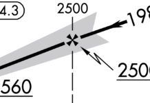
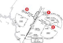
The Rutland missed is a complex path back to KOPVE for a hold. On first glance, there are four steps involving several facilities on the plate. But a closer look shows there are actually six steps (the six are more clearly shown on the NACO plate). The Rutland VOR (RUT) must be tuned, identified and set for R-225 prior to beginning the approach. If possible with your equipment, get the Cambridge VOR (CAM) ready in a standby, as you’ll need it too.
The missed approach starts with a climb southwest on RUT R-255 for 7.5 miles to FAROX. Next, you’ll make a climbing right turn to intercept the CAM R-033 to KOPVE and hold. This route is over the north-south mountain ridge forming the west side of the Rutland basin. More importantly, this ridge is what is referred to as “missed-approach obstructions” on the LOC Z approach and is why you need a climb gradient 50-percent steeper than standard. Remember, that’s 300 feet per mile not feet per minute. If your groundspeed was 120 knots on the missed, you’d need a climb rate of 600 FPM.
But consider doing the published missed with a 30-knot east wind—not impossible even with low ceilings when the hills funnel the winds. That could be a groundspeed of 150 knots and a required climb of 750 FPM. Not a problem for a Citation, but it could be a problem for many light aircraft. A strong northerly wind would reduce the altitude climbed to prior to FAROX and make a good climb gradient necessary for the turn over the ridge.
The real kicker, though, is a westerly wind that can make significant downdrafts. Imagine departing FAROX and hitting a 2000 FPM downdraft. That’ll turn all but a turbine-powered climb rate into a net descent—right into the rocks. Plot the missed approach on a sectional chart and you’ll see that the turn from FAROX is directly into the mountain ridge. Not good mountain-flying practice.
There have been times when doing a practice missed approach in a Cessna 172 in visual conditions that I had to turn well inside of FAROX and basically climb back up the localizer path to KOPVE, as I could not out climb the terrain. Unfortunately there’s no way to predict this before you start the approach. The Rutland AWOS is in the bottom of the valley, where the winds could be still or completely opposite. The nearest winds aloft forecasts are at Plattsburg and Albany, N. Y., each 70 miles distant from Rutland, making their forecasts cautionary but certainly not locally precise in mountainous terrain. The best you can do is note the winds on approach, estimate their effect on your climb gradient for the missed and be ready to abort the approach if those rates would be inadequate. Oh and do this while you’re still concentrating on flying the approach!
For all the beauty of the Green Mountains, Rutland is not the place to do approaches in the soup when it is windy unless you’ve got big blowers for power. Skip Rutland and try Burlington, Glens Falls or Albany. Rental cars are cheaper than dispatching recovery teams to the mountains.
Ian Worley is a freelance instructor. He lives in Northwest Vermont.


