You’re living the good life and working the system—the tax system. You work in Portland, Oregon, with no sales tax, but live across the river in Vancouver, Washington, with no income tax. So, you can at last afford that glass-panel bird. After flying it across the U.S. to bring it home, it’s finally time to load the last approach of the trip: The LDA-A into Pearson Field in Vancouver (KVUO).
Except the approach isn’t in the GPS database.
Where’s My Data?
You can’t use GPS to fly a localizer-based approach, but it’s common to load the approach into the navigator and let it dial up the localizer frequency and paint the stepdowns on the moving map. For many of us the last time we manually tuned a nav radio we read the frequency off a paper chart. Glass-panel pilots might have to dig into the book to remember how to manually dial a course on the digital HSI.
So, where’s the approach? Callout to my colleague John Ewing for getting the answer from Jeppesen. This approach uses the localizer for the ILS 10L at nearby Portland International (KPDX). Using one localizer for two different airports is so rare that ARINC database coding has no system for it. Pearson is the step-child, so it gets the boot.
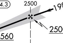
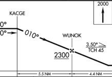
Presuming you figured out entering the localizer frequency and the course, the question is how you fly the stepdowns. You could simply load the ILS Rwy 10L at Portland, but that approach only gives you the first two stepdowns of BUXOM and TRAYL. (BUXOM? Nope. Not goin’ there.) To descend for 700 MSL you need ZEZJI, and QEHBY is the MAP.
The retro way of finding crossing radials off the Battleground VOR (BTG) works for BUXOM, TRAYL, and ZEZJI. What about identifying the MAP at QEHBY? That’s Ernest Gann retro: Timing!
There’s another way. In fact, there are two. The four stepdowns on the LDA-A can be identified by DME off the localizer itself. Presuming you use GPS in lieu of DME, you can load the localizer as a waypoint. Enter direct to IVDG, which should be in your GPS database. Even better, enter direct-to on a course of 103 and get the final approach course on your moving map. Use your distance to IVDG for each of the stepdowns and the MAP.
Take it one step further and build an approach of your own. The fixes BUXOM and TRAYL are in the database because of the ILS 10L approach at Portland. Load them as waypoints in your flight plan. If the fixes ZEZJI and QEHBY are in the database (they appeared to be as of this writing), load them as well. Load IVDG next, and BTG as the final waypoint in case you must execute a missed.
Now you have clear countdowns and crossing of each stepdown, just as if this was a database approach. Remember however: This is not an approach and is not subject to the same fault detection as a real approach. You’re still flying the localizer and raw data. You simply gain some situational awareness on the map and easy-to-read stepdowns.
If the last two waypoints aren’t in the database, you could still create them on your own as user waypoints. Add each one as a distance and radial from IVDG. Give them an appropriate name and use them in your flight plan.
Is that legal? You have a pretty good argument that radial and distance (rho-theta) is how they’re defined using DME, so why would it be wrong to record that as a waypoint?
Other Oddities
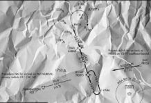
Once you’ve gotten the approach set up, there are a couple other items on the chart worth note. There’s no IAF for this approach, so radar is required and so noted in the plan view. ATC must vector you onto the intermediate or final approach course.
The MDA is high. When you cross ZEZJI at 860, you’re already at a four-degree descent angle to a point 1000 feet down this runway. So if you have to level off at 700 for any length of time before you see the airport, expect to circle around in some fashion to land.
The runway isn’t that long. Landing relatively straight in on Runway 08 gives you about 3200 feet from brick one. If you circle for Runway 26, the displaced threshold cuts that to 2500 feet of landing pavement. You see this roughly in the airport diagram on the approach chart, and the but you’ll want to check the A/FD for the exact number.
The A/FD also reveals it’s right traffic for Runway 26 and that the VASI for Runway 08 is only useable six degrees left and right of course. There’s even a note to remain below 700 MSL over the runway extended centerlines due to wake turbulence from airliners operating at Portland. Hey, you knew the airports were close.
One Last Catch
Landing traffic at Portland could throw one more wrench into your Vancouver approach plans. Runways 10L and 28R use the same localizer frequency of 111.3. That means if Portland is landing Runway 28R, this approach isn’t available because the localizer is pointing the wrong way. Flying it raw data is one thing. Hacking an unpublished LDA “backcourse” is something else entirely.
Could you ask them to just switch the runways at Portland momentarily for you? “Sure,” says the controller. “That’ll just be a landing tax of $2500. Will you be paying by credit card today?”
Jeff Van West doesn’t mind paying taxes. It reminds him that another year has gone by without him being completely broke. Sort of like chronic joint pain reminds you you’re still alive.


