There are only 25 or so Localizer-Type Directional Aids in the National Airspace System, according to the Instrument Procedures Handbook. When accounting for multiple approaches from one LDA facility, you’ll find around 30 approach procedures sprinkled across the system.
So unless you’re flying to places like Sitka, Alaska; Honolulu, Hawaii; or Fayetteville, Arkansas; it’s uncommon to encounter or need this kind of approach. But they are around.
Among these procedures you’ll find a surprising variety of features. But here are the common threads: The LDA is made up of a localizer transmitting a course signal with the expected beam width of three to six degrees, but it will be offset by as much as 30 degrees, even when advertised with a specific runway.
This is why it won’t be called a LOC approach, and in some cases has noticeably higher minimums to allow for the final jog or turn to line up with the runway once it’s in sight. (Offsets greater than 30 degrees, as you’d expect, would make them circling approaches.)
Some LDAs require DME. Some of these have a glideslope, but you must look for an “LDA/Glideslope” label on the plan view because it’s not in the name. Curious? Good. There’s more to these than meets the eye.
What? No ILS?
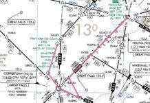
A trip to the “Grand Canyon of Texas” could end up with an LDA-with-glideslope approach. Rick Husband Amarillo International lies just northwest of Palo Duro Canyon State Park and the list of IAPs includes the LDA/DME 22. The plan view says a glideslope is required. The offset from the runway isn’t too bad, with a final course of 214 degrees.
Published minimums for the LDA/GS take you to 250 feet above TDZE on a three-degree glideslope, and require a half-mile visibility. These minimums take you as low as many full ILSes, so that’s a perk. Plus, you’ll notice the lack of obstacles along the approach course and a runway that’s well over 13,000 feet long, making this an overall user-friendly approach.
The only real eye-catcher on the IAP is the prohibited area, P-47, northeast of CIXFE. A prohibited area on the final approach course? Whasupwidat? P-47 covers the surface to 4800 feet MSL, which is why the intermediate portion of the approach keeps you at or above 5000 feet. (In case you’re wondering, P-47 is a government facility that works with nuclear weapons, providing plenty of reasons to stay clear.)
If you’re RNAV-challenged, you’re probably thinking you could use the ILS 04 approach that avoids that scary airspace. It has circling minimums of 500 feet, same as the LDA circling approach.
Sure, just keep in mind that you’ll still need DME (or ADF) to fly the ILS, so similar equipment is required. The especially equipment-challenged will be out of luck on instruments. And if you made this trip on your mid-summer vacation, you should have spotted the NOTAM that listed the ILS out of service ‘til July 8.
No Two Are Alike
In contrast to the approach in Amarillo, the LDA/DME Rwy 25 approach at Columbia Gorge Regional in Oregon is much busier. The name of the airport says it all: This approach runs southwest-bound down a river gorge, starting at VECCU and stretching out over the scenery for nearly 13 nm to the runway.
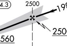
The final approach course is 238 degrees, and a look at the localizer frequency box shows it to be about 15 degrees off runway alignment. While the offset isn’t too bad, the reasons for the offset ought to have grabbed your attention by now—the surrounding terrain that forms the gorge, plus the arrays of towers gathered north and south of the localizer. Interesting, too, is how the localizer feather on the plan view fits snugly into the gorge, speaking volumes about the conditions.
The stepdowns are fairly straightforward given the environment, starting high (5300) relative to the airport elevation of 247 and going to 4500, then 3800 at glideslope intercept. However, keep an eye on the other components of the profile view and things get interesting. The GS intercept is a further-than-normal 7.9 nm from the runway, and has a 4.2-degree slope going down to 1368 feet, more than 1100 feet above the TDZE. Add the three-mile visibility requirement and this procedure is well in the realm of non-precision, non-aligned approaches. In fact, the final course heads right for a localizer that’s offset from any runway on the east side of the airport. It’s actually adjacent to the airport’s closed runway, as depicted on the airport sketch.
Also note the lack of a Maltese cross where the GS intercept starts at LIREY. This is not a glideslope-optional approach and offers no localizer minimums; the obstacles lining the final course require a constant descent profile to the runway. And for those of you arriving at more than 121 knots, you’re out of luck. Categories C and D are NA.
All this just shows how the name of an approach only tells you so much, especially when it comes to those LDAs. Be sure to check the specifics to avoid surprises, like an LDA with a required glideslope. Being an LDA/GS and not an ILS in the first place, should tell you that something unusual is going on.
Elaine Kauh is a CFII in eastern Wisconsin, where she gets around in an equipment-challenged Subaru with a stack of road maps.


