
Most weather phenomena that pilots encounter involve clouds, so knowing the types and what forms them gives us insight into how our flight will be affected. Knowing a bit about clouds also helps us learn the mystical language of weather forecasters, briefers, and technical NWS forecast discussions that some of the more astute pilots may tackle.
A cloud is the visible manifestation of liquid water droplets or ice. It forms when humid air cools sufficiently for water vapor to saturate and produce condensation—the dewpoint temperature. On a dry summer day in California, this temperature might be 20 degrees F, and the weather remains clear. On more humid summer days in California, the cloud formation temperature might be 50 degrees, producing morning clouds along mountain peaks.
When air is chilled to the dewpoint, the humidity becomes 100 percent and from the texts we expect saturation to occur. But in real life this doesn’t always happen. If a given volume of air doesn’t contain condensation nuclei—microscopic bits of dust, pollen, etc.—the relative humidity may exceed 100 percent without producing clouds. But for the most part, this relationship between temperature and dewpoint is correct.
Things Get Hazy
Pollution can also upset “normal.” The common culprit being sulfate aerosols in industrial regions. In sufficient concentrations with humidity as low as 60 to 70 percent, water vapor combines with aerosols to produce microscopic sulfuric acid droplets seen as a veil of haze, usually below 10,000 to 15,000 feet.
Research and multispectral satellite images have shown that most haze in the United States originates from sulfates generated in industrial regions of the Midwest and Northeast. During winter it tends to be quickly swept away by strong winds, but during the summer it slowly swirls around the Eastern U.S., perhaps blanketing the Southeast then recirculating across the Mississippi Valley and back to the Great Lakes. Other times it sits over the Northeast or moves north, bothering Canadian aviators.
Satellite imagery has also shown that a lot of summer haze in the southern U.S. actually originates from African dust storms! Powerful “haboob” storms are known to kick up vast clouds of dust, which are carried westward in the tropical easterlies, arriving several days later in the Caribbean and Gulf regions. From there the dust may be either drawn north into the Midwest or westward into the southwest monsoon.
When it reaches the U.S., African dust isn’t dense enough to blot out the sun, but it will definitely give a pale tinge to the sky and drop visibilities to as low as three miles. The dust provides the nuclei for coastal fog during the early morning hours and might slightly compound haze from the northeast U.S.
Cumuliform and Stratiform
Cloud types are divided into two main categories: cumuliform and stratiform. Cumuliform is derived from the Latin word for “heap,” so it’s accurate to say that heap-like, billowy clouds are cumuliform. Most cumuliform clouds are the result of convection, the vertical transport of air due to heating from below, or from forced lift over mountains.
Stratiform comes from the Latin word for “layer,” so sheet-like textures describe them best. They usually result from large, uniform regions of lift or cooling, rather than from pockets of localized lift or heating. So, large, organized weather systems are efficient producers of stratiform clouds.
The simplest type of cumuliform cloud is cumulus. This is the classic puffy cloud that you see during the warm season. Its bases are normally about 4000 feet, though this can range from about 1500 feet during the morning hours to over 10,000 feet in desert regions. Using degrees Fahrenheit, the formula ((Temp – Dewpoint) 4.5) 1000 yields cloud-base height in feet. This formula gives you a good ballpark figure to make your own predictions or for when the cloud-height report is missing.
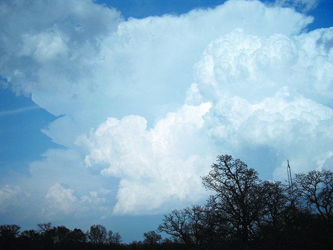
The dreaded cumulonimbus is a cumulus cloud that has taken on great vertical and horizontal extent and has a fibrous texture at the top: this is the manifestation of rain, graupel, hail, and ice. After about an hour it develops a distinct anvil-like shape. The top of a cumulonimbus cloud averages perhaps 30,000 feet, but may range from as low as 15,000 to over 60,000 feet. Severe storms are often associated with the higher ranges, but tropical air masses with high tropopauses also allow tall storms. It’s not uncommon for even weak storms in places like the Philippines, Indonesia, and Brazil to reach 70,000 feet.
The most important skill to have when trying to interpret a cumulonimbus cloud is to understand the basic structures involved in a storm. A thunderstorm is made up of a cloudy updraft, which is the cumulonimbus cloud itself, and a clear or precipitation-filled downdraft, which falls out of the cumulonimbus cloud. This means the updraft will look like a massive cauliflower cloud, at least early on, while the downdraft will be made up of a large virga column or rain shaft. Sometimes these areas are difficult to distinguish from one another. And when it comes to radar, the downdraft is mostly what you will see. But both parts are hazardous.
Low Clouds
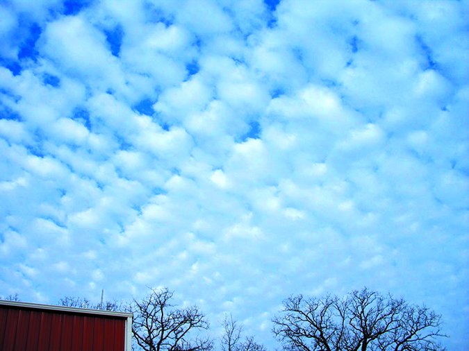
When solar heating is not very strong, pilots may encounter the stratocumulus cloud. A common altitude for stratocumulus is 4000 to 7000 feet. It has heaplike elements but overall is fairly flat and may merge into a layer covering the entire sky. The presence of stratocumulus tells you that there is an inversion just above the cloud layer. With smaller stratocumulus clouds, there’s seldom much ice risk except for some rime icing during the cold season.
Stratocumulus may occasionally aggregate together into thick layers, occasionally topping out near 8000 to 10,000 feet MSL. These bring some icing risk, especially in the cool season near the top of this cloud. In this scenario it’s always a good idea to check PIREPs to get a handle on the cloud tops, and tie that in with the freezing level and forecast icing layers. This will tell you if a different cruise altitude might be warranted.
Stratus is the most benign of all clouds. Classic stratus is a uniform, featureless layer low to the ground, often about 500 to 2000 feet high, but the word is also a catch-all for any formless cloud found close to the ground, including the scud cloud we see around rain areas. Because of that, forecasters sometimes differentiate them as “good-weather stratus” and “bad-weather stratus.” Overall, stratus is best thought of as fog, except that it lies just above the ground. The development mechanisms are actually very similar, and regions of widespread fog will often lift into layers of low stratus once the sun rises, sometimes even becoming cumulus with further heating.
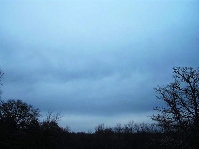
By contrast, nimbostratus is the worst of all during the winter months. It is a bad-weather cloud associated with large-scale lift of humid air. The air mass is often slightly unstable. Despite what many Internet photos suggest, it is completely featureless, the only elements being virga and perhaps layers of low-level scud (stratus) beneath. Nimbostratus is quite deep, often topping out at over 20,000 feet, and during the cool season it often contains substantial icing risks. Normally this cloud is found around frontal systems when plenty of IFR is on the charts.
Middle Clouds
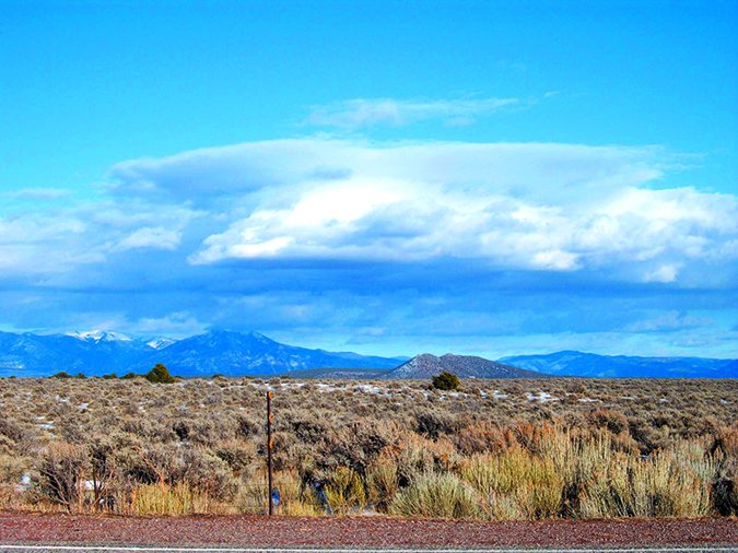
Forecasters recognize two types of middle clouds: altocumulus and altostratus. They’re differentiated mostly by texture. These middle clouds are by international convention found anywhere between 6500 and 20,000 feet in temperate latitudes.
Altocumulus has a puffy, patchy, or roll-like texture. During the summer months it is usually the result of debris from thunderstorm activity the previous day, while during the winter it tends to come from sources of organized upper-level lift. Pilots should be attentive for the type known as altocumulus castellanus, which is a form of altocumulus with unusually vertical elements. This is an indication of enhanced low-level turbulence risk and the possibility for strong storms later in the day.
Altostratus is a nondescript, uniform layer that tends to fill the sky. It brings with it icing risks, and over a period of hours it often deepens below and above into nimbostratus as frontal systems approach. So when you see altostratus, double-check the forecasts and make sure all your ducks are in a row. The rule of thumb that forecasters use is when the sun shines weakly through the cloud like ground glass, it is altostratus, but when the sun cannot be seen anymore through the cloud, it is nimbostratus. Once nimbostratus is present, precipitation is already underway and is likely to reach the ground in a matter of hours.
High Clouds
That brings us to our last three clouds. High clouds are found at an altitude of 20,000 feet or higher, so you’ll probably need a turbocharger and oxygen if you want to go up to have a look at them. Some of these clouds are occasionally found well above 30,000 or 40,000 feet. They are always made up of ice crystals, and given the very cold conditions the dominant type of icing in them is light rime icing.
Cirrus is the classic high cloud, appearing as distinct tufts or strands that might aggregate into patches. The cloud is made up of fallstreaks of ice crystals. Normally the cloud is associated with fair weather, but in cases of unusually strong lift, the fallstreaks consist of very strong cascades of precipitating ice, giving the clouds a distinctly vertical appearance. You can expect downdrafts and some turbulence just below these clouds.
Cirrostratus is a veil-like cloud. The term “veil” should be emphasized, because in its textbook form it appears like a featureless sheet that produces a wide variety of halo phenomena around the sun and moon. Generally when you see cirrostratus, it’s a good sign that an organized weather system is on the way, but you can also be assured that flying conditions will be good for the time being, and icing and turbulence should not be a factor.
Finally that brings us to our last cloud form. Cirrocumulus clouds consist of patches with very small turret elements. It’s actually a fairly rare cloud compared to its cirrus and cirrostratus siblings. The presence of cirrocumulus is a good indicator for clear air turbulence, though most of this will be in Class A airspace.
Wrapping It Up
We’ll part with a couple rules of thumb. First, if a cloud is producing any precipitation besides drizzle, you should assume that cloud top extends at least a thousand feet above the freezing level. This is because most precipitation we encounter develops due to the cold cloud process. Exceptions to this are found in very moist air masses, particularly in the tropics. Even so, our rule of thumb errs toward the cloud being deeper, giving us a margin of safety.
Another rule of thumb holds that if an overcast layer of stratus or stratocumulus is present without precipitation, VFR on top or between layers is likely possible. The lack of precipitation is a good sign that the tops of the low cloud layer don’t extend above 10,000 feet, otherwise precipitation formation processes would have already begun. Of course rules of thumb are just that, so they should be used to confirm what you’ve gathered from your forecast briefing rather than to refute it.
Hopefully now we’ve made you a bit of a cloud expert and highlighted that the clouds aren’t just annoyances to be avoided, but offer a lot of clues about what’s going on. When trying to read the sky, always put things into perspective and go back to the basics. The tips we’ve given here will be plenty enough to help you begin figuring out where a particular cloud came from and what it means.
Stay safe out there.
Tim Vasquez is a professional meteorologist living in Palestine, Texas. See his web page at WeatherGraphics.com.


