Careless Editing
I was excited to see my submission in OTA of the February issue but a slight change in wording could lead the reader to think that PALS pilots are paid.
To clarify, Patient Airlift Services is a volunteer organization that transports sick patients and their families for medical treatment. I wouldn’t want this charitable organization to be misrepresented. The exchange I heard was between the controller and an air carrier.
Joe Sandberg
Lumberton, New Jersey
Logging Database Updates
It is my understanding that one needs to make an airplane logbook entry each time you update a database. It is maintenance.
This means every month I make a sticker to put in the log when I install those updates. But I have looked at logbooks of aircraft for sale and noticed none of them have any entries for database updates. Am I wrong about the logbook entries?
Charlie Schobel
Norcross, Georgia
We posed your question to Kim Santerre, editor of our sister publication, Light Plane Maintenance, and it set him on quite an odyssey of exploration. His conclusion is that the entry is currently not required unless the maintenance requirements or instructions for continued airworthiness of the box you’re updating say you should make a logbook entry.
But, there’s another perspective: Having bought and sold a few airplanes over the years. I’ve always sought to maintain impeccable logbooks, with receipts and all assorted paperwork, even though it’s not required. When purchasing, I look for the same. My reasoning is that thoroughly detailed logbooks instill confidence in a buyer and can make the plane easier to sell, and at a better price. Good logbooks suggest good maintenance.
So, my advice is to create a separate form you keep in your logs on which you simply record database updates. In fact, I do that and I’ve also got a record of VOR checks similarly recorded. You do your VOR checks, too, right?
Why Radar?
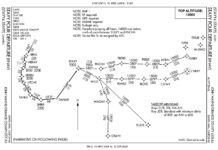
I was planning to fly to Manchester, New Hampshire, but had some questions about the ILS35. Why is radar required for the IAF at Lawrence (LWM)? Where would the approach commence if you wanted to do the procedure turn? (From MHT to POPVE INT)?
Elliot Perlman
Providence, Rhode Island
Any IAF that isn’t on an airway and doesn’t have a feeder from an airway automatically requires radar for proper identification. Since LWM is not on an airway, radar is required if the approach is to begin from there.
There are two IAFs for this approach, LWM as discussed above, which is annotated NoPT, and POPVE. From MHT there is a feeder to intercept the localizer at POPVE, the IAF. You then turn outbound on the localizer and fly a procedure turn, as you suggested.
Also note the depiction of FERNS intersection. Some might think FERNS is a fix on a feeder route, but the course line isn’t thick enough, so it’s just a reference. It’s tempting to fly from FERNS to intercept the localizer outbound through POPVE for the procedure turn, but that’s not a charted feeder.
Visual Objections
Fred Simonds’ “The Vis” in the December 2013 issue was a good article about visual approaches. There are just a few things that I would like to comment on that I think need clarification.
First is the use of the Southwest accident into KLGA. That flight did not crash because it was on a visual approach. It is a stretch and misleading to lump the Asiana and Southwest crashes together.
The second comment I have is about the sentence “Large commercial operators, though, prefer to remain under IFR…” For Part 121 operations VFR flight is controlled by OpSpec C077 and this can be very restrictive. It is not really a preference as much as a requirement.
The third comment I have is about the “Stabilized Visual Approach Tips” section. In the last paragraph Fred says to use the ILS or VGSI to avoid getting low. Very good advice, but why not include an LPV? Those equipped can use (and may prefer) the LPV especially at those thousands of airports that have an LPV approach, but lack an ILS.
Justin Gillmor
Maple Valley, Washington
We did err by saying Southwest was on a visual, They were cleared for the ILS. But conditions were visual and they reported the runway in sight from 5-10 miles out. Whether they were flying a visual, the ILS or using the ILS to supplement a visual approach (as is common) was irrelevant to the points being made in the article.
It’s true that the difficulties experienced by Asiana were more specifically related to flying a visual approach since the glideslope was out of service. The commonality, though, that we were focused on is that both flights were, or became, unstabilized toward the end of an approach being made in visual conditions, and neither crew performed a simple go-around to save the day. (Or, if you wish in Asiana’s case, at least not in time.)
The boilerplate Operations Specifications C077 contains a provision for cancelling IFR in Class B, C or D airspace, or within 10 miles of an airport in Class E or G airspace. That capability is seldom invoked, either due to internal restrictions that might even remove it, pilot choices or lack of real need. Granted, this is a bit of a semantic argument, but we feel that “prefer” worked and saved a paragraph to explain Operations Specifications.
Your point about using the LPV vertical guidance is spot on, and we must admit to falling victim to the very same ILS mindset we railed against in Jordan Miller’s November article, “It’s Time for GPS.” As penance for our oversight, Jordan assigned us 10 LPVs at airports with ILSes.
Whether Or Not Weather
Can you explain why the NEXRAD images I see sometimes paint weather that isn’t there?
I recently departed CHS enroute to Florida with a clear weather forecast. My downlink showed a few medium intensity cells around Beaufort, South Carolina that seemed easy enough to avoid. But, as I drew closer my eyes reported clear skies all around. I was still speaking to Charleston Departure and he said he saw the cells, too. In fact, though I was in the clear with only scattered cirrus above, my display claimed I was in the middle of low to mid-level precipitation.
A bit later I was talking to Savannah approach, and he reported the weather as clear. Another pilot on frequency said he was also depicting medium to heavy precipitation on his downlink.
I respect the latency of datalink weather, but this is something more worrisome. If they paint bad weather that isn’t there, how can I be sure they won’t fail to paint bad weather that does exist?
Digby Solomon,
Williamsburg, Virginia
This, direct from the meteorologists at WxWorx, the provider of XMWX satellite weather:
The weather returns shown on XMWX on the morning in question, illustrate what is known as radar Anomalous Propagation (AP). Virtually every evening through mid-morning during the late spring, summer and early fall, temperature inversions—cooler at the ground and warmer aloft—occur in the lowest several hundred feet of the atmosphere. This is especially true in the southern and eastern U.S.
The radar beam hits this inversion and bends toward the ground instead of continuing upward. The beam will eventually hit the ground and part of the beam is reflected back to the radar itself. The radar sees these returns and displays them as actual precipitation. Because this happens on a nightly basis, we at Baron [WxWorx], have a dedicated team of meteorologists who eliminate as much of this AP as possible. However, often times along the southeast U.S. coast and over water at night, light showers do develop and dissipate fairly quickly. We always make sure that these showers are never left out of the radar images we distribute. When these two conditions occur, as they did that morning, there can be some AP that does get sent out to customers.
You can see in the attached image that there were showers well off the Carolina and Florida coast but the precipitation showing near Charleston is in fact AP.
We read ‘em all and try to answer most e-mail, but it can take a month or more. Please be sure to include your full name and location. Contact us at [email protected].


