The second leg of your Tennessee-to-Kentucky journey (see January IFR) is going more smoothly than the first, but there are yet some tough decisions to make before parking for the night at Lexington, Kentucky. There’s the matter of working around a busy airport with a runway closure in marginal VFR weather. Oh, and it’ll be dark when you arrive, adding more complexity to this single-engine solo trip.
Lots of NOTAMs
After a self-serve fuel stop at Springfield Robertson County Airport in Tennessee, you update the briefing for the next 142 miles to Lexington. So far today, you and your no-GPS Cessna 210 escaped the grips of a local TFR and flew out ahead of approaching storms. If you can just get to Lexington tonight, conditions will clear up nicely for tomorrow’s leg to Ohio. For now, the tops en route will be about 6500 feet and reports indicate no icing below that.
You’ll cruise at 7000 feet via: EWO V178 SAAPP HYK. The Lexington VOR’s not required, but it’s a transitional navaid for going inbound (and is the missed-approach hold) for the airport’s two ILS approaches, which is the best your equipment can do. You figure if it’s congested and you have to wait to get in, you can also hold there above the overcast in good visibility rather than endure vectors in the clouds.
The terminal forecast calls for 1000-5 when you’ll arrive just after sunset, so you expect to fly most of an ILS approach (available for both Runway 4 and 22). That’s fine on its face, but today it won’t be an everyday procedure. That’s because Runway 4/22 is closed for one more day following maintenance. It’s really a non-issue as 9/27 is 4000 feet, but that crimps the options since there are only RNAV procedures for those runways. Winds are less than 10 knots, favoring 22 and 27.
While previewing the traffic flow, it appears that most inbounds are using the RNAV 27. And a few, relegated as you are to the ground-based procedures, are flying the ILS 22 and steppin’ over to land on 27. Oh, and make that LOC 22, since that glideslope is out of service. Sigh… At least the phone call ahead for a clearance gets you “as filed” to Lexington.
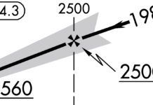
Yet the NOTAM parade continues: LEX: “RWY 04 RTZL U/S” is effective for a few more days. Plain language, please: RTZL stands for (Runway) Touchdown Zone Lights. On the approach chart’s airport sketch, “TDZ/CL Rwy 4” indicates something along those lines, but you’re not landing on 4, so it probably doesn’t matter. But curiosity gets the best of you. Plus, you’ll still want to identify that runway in the dark for situational awareness.
Turn to the IFR chart legend, which at first glance only muddies the waters. (Yeah, it can do that.) There are scant references to “RTZL” or “TDZL” and on the page of lighting system sketches, they appear to be two lines of lights that parallel the CL (Centerline Lighting), presumably illuminating the touchdown zone.
The latter, in the daytime, is defined in TERPS as the first 3000 feet of landing surface on a precision runway. The lighted version takes more digging, but pays off: TDZL in the AIM (2-1-5, “In-runway lighting” text, don’t bother with the runway figures): are white lights “which start 100 feet beyond the landing threshold and extend to 3000 feet beyond the landing threshold or to the midpoint of the runway, whichever is less.” That’ll suffice for now, and later you can use this to impress your friends.
Alternate and Plan C
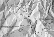
Another backup plan will be the alternate you filed for Lexington, Capital City at Frankfort (KFFT) to the northwest. You’ve admittedly popped FFT in previous filings without checking anything, much less the fine print of the alternate minimums. But after learning the hard way to get standard briefings for alternates, it turns out that your lack of an IFR GPS triggers a catch—a tiny but essential note on an approach chart, about which better-equipped aircraft don’t have to worry: The LOC 25 notes say Alternate NA. That’s what you’d use if diverting to Frankfort. Meanwhile, the other IAPs (RNAV 7 and 25) have just the icon for “NA when local weather not available.”
There’s another wrinkle when checking the only other ground-based approach at Frankfort: The VOR 25 has no alternate note. The least popular, least precise approach can be an alternate without restriction, but not so for the localizer? It’s true: Alternates are tied to approaches, not just airports. The distinction depends on the reason for the note; in cases like this it’s usually due to unmonitored navaids. Lack of weather reporting is another common limitation, and “NA at night” often results from unlit obstacles.
While you don’t relish the thought of the VOR 25 approach as your backup, odds are it’ll never come to that. Two reasons: One, getting into Lexington is more likely than any other outcome. Two, you’ve got Louisville as a better plan B. Frankfort isn’t all that far from Lexington and the conditions for both airports could degrade.
But, why not just list Louisville? You can, but it’s another 30 minutes west of KLEX and there will be days when the IFR fuel requirements won’t allow a diversion further away while landing with 45 minutes of reserve per §91.167. So you can keep Frankfort in your saved route as the filed alternate and use Louisville as a personal backup. Just make darn sure you tag KSDF (Muhammed Ali International) with its multiple ILS/LOC options, and not KLOU (Bowman Field), a satellite with only RNAV and NDB approaches.
Which ILS?
It’s now 6:15 p.m. local, official sundown, and you’re 30 minutes from Lexington airspace. Good thing the weather remains as forecast. But there’s still a healthy 30-knot tailwind aloft as you proceed. That prompts you to consider requesting the ILS 4 and its working glideslope to get into visual conditions, which leads nicely into a left downwind for 27. You are coming in from the southwest, so that would be convenient too.
Chances of getting this, though, are slim given the traffic flow to 22, but if there’s spacing for you to get cleared for ILS 4, circle to 27, that’d give you a couple minutes to fly a standard pattern well above circling minimums because you can stay in VMC at 900 to 1000 feet AGL. Meanwhile, there’s no TDZL or PAPI operating for this approach, but 4/22 runway lights will be on for identification, after which you’ll be landing on Runway 27 with its own PAPI.
Say you had either option. Which works best for a night approach to 27? ILS 4 has a short 3.3 NM from the final approach fix starting at 2200 feet; you can expect to break out just past that. As long as you’re aware of the tailwind on the downwind to 27 and you put the gear and some flaps down once in VMC, you can win a light workload for landing.
On the other hand, the LOC 22, with a 6.6 NM segment from the FAF (3200 feet intercept) will take longer in the vectoring and intermediate segments but offer the slightest “circle” to jog over to 27. That’d be a 41-degree course change to line up (226 degrees magnetic to 267), and with both runways before you when breaking out of the clouds, SA would be quite good using that option, too. Maybe taking more time will keep you outta trouble. Again, out of curiosity, you decide to ask Approach if the ILS 4 is even available, just to know.
You get your answer: negative, due to opposing traffic, which isn’t expected to let up for a while. Might as well accept vectors to the northeast and get in the mindset for the LOC 22. And it wouldn’t hurt to re-brief just so there’s no mixup with the different distances and numbers for the other ILS. The final two miles after breaking out was much easier than you thought, as you simply followed another aircraft inbound to 27 while double-checking that you’ve changed the runway heading bug to 267 degrees.
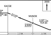
In fact, you were even savvy enough to put the RNAV 27’s final approach course and its two-mile fix, LAKWA, into your EFB so you could double check that your altitude at that point (1700 feet) was suitable. That allowed for a stable descent for the next 700 feet, followed by an easy landing. The payback after all that work? Tomorrow’s CAVU weather for the next flight to Ohio and then back home—just don’t forget to check all the NOTAMs.
Elaine Kauh is a flight instructor in eastern Wisconsin. She specializes in the fun stuff like studying charts, checking NOTAMs and, of course, circling approaches.


As a CFI-I and a pilot who flies a great deal of single-pilot IFR (often in IMC), I especially enjoyed Elaine Kauh’s thoughtful and comprehensive article “Finish the Job” in the February issue. She posed a plausible scenario and explored all the options that were made even more challenging by flying a no-GPS Cessna 210. I will use it as a teaching tool for my IFR students. Thanks for the excellent job, Elaine.
Victor Vogel, CFI, CFI-I, IGI